Example Problems
| The examples below are intended to explore the use of the various tables that make up the F-Tafel and the different plotting techniques. To create the examples the data for observed altitudes for a given position, date and time were taken from the US Naval Observatory page Celestial Navigation Data for Assumed Position and Time. The "true ship's position" for each observation is given at the end of the example. In theory the plotted intersect position should match the should match the "true ship's position exactly. Discrepancies arise from the inaccuracy of the F-Tafel tables, the many interpolations made while reducing the sight and from plotting errors. | ||
 |
Click the icon to proceed to the US Naval Observatory website page Celestial Navigation Data for Assumed Position and Time | |
Example 1
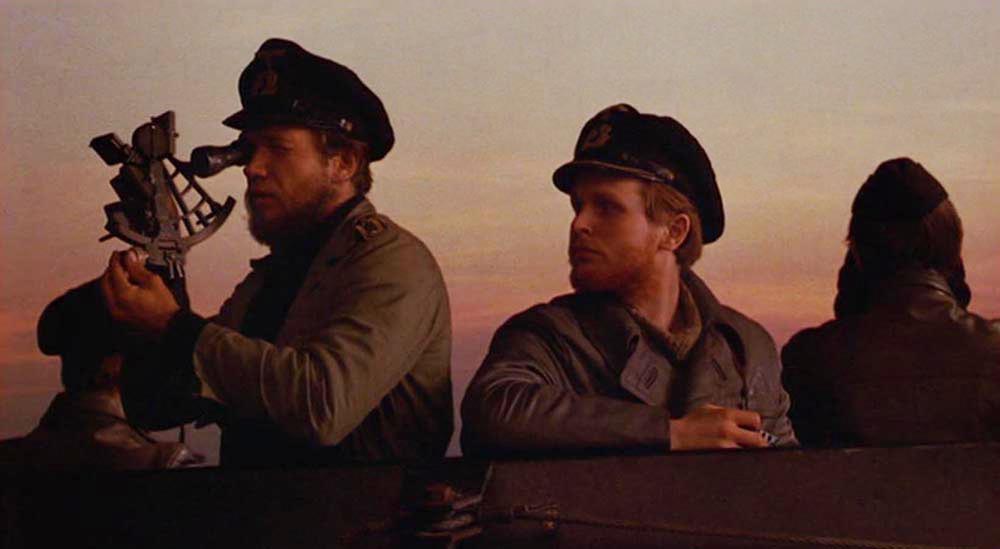
| In the scene above from the movie Das Boot the boat's navigator, Obersteuermann Kriechbaum, takes an evening sight with a standard Kriegsmarine Cassens and Plath sextant. On 26 November 1941 the real U-96 was preparing to enter Vigo Spain to refuel the next evening. The navigator, Obersteuermann Wilhelm Lanjus-Wellenburg, took a morning sight. The example below is based on the actual location and celestial bodies available at the time. You can see the war diary of U-96 by clicking on the link below. | ||||
 |
U-96
|
Lehmann-Willenbrock
|
27 OCT 41 - 6 Dec 41 |
7th patrol - North Atlantic - Basis of Buchheim's novel Das Boot |
Example 1 is a 3-star observation plotted without baseline shift. The observations were taken nearly simultaneously and are plotted from the same assumed latitude and DR longitude. |
||||


Assumed Latitude = 45° 00'N |
DR Longitude = 14° 36'W |
|
27'S |
11'E |
|
Latitude = 44° 33'N |
Longitude = 14° 25' W |
|
Actual Position |
|
Latitude = |
44° 33'N |
Longitude = |
14° 25'W |
Example 2
| U-454 was one of the first boats to take part in operations against an Arctic convoy to Russia. On 29 December 1941 the boat's navigator Obersteuermann Rudi Dreischke took a stellar celestial navigation fix before the boat took its position in a patrol line. The sun never rose in the Arctic in December but there was enough light from the sun just below the horizon to take the shots. You can see the war diary of U-454 by clicking on the link below. | ||||
|
U-454
|
Burkhard Hackländer |
25 DEC 41- 20 JAN 42
|
1st Patrol/Arctic - PQ-8 |
| Example 2 is a three star observation plotted without baseline shift. This example uses the 70-90° Latitude pages of Table FI. The observations were taken nearly simultaneously and are plotted from the same assumed latitude and DR longitude. | ||||


Assumed Latitude = 73° 00'N |
DR Longitude = 20° 22'E |
|
15'N |
10'W |
|
Latitude = 73° 15'N |
Longitude = 20° 10'E |
|
Actual Position |
|
Latitude = |
73° 15'N |
Longitude = |
20° 10'E |
Example 3
| U-106 was tasked to escort the blockade runner LECH from Rio Brazil out of the USA blockade area. The day before landfall U-106 was cruising on the surface in good weather. The navigator, Obersteuermann Alfred Kruel, probably took a series of sun observations. You can see the war diary of U-106 by clicking on the link below. | ||||
|
U-106
|
Jürgen Oesten |
26 FEB 41- 17 JUN 41
|
2nd Patrol/South Atlantic |
| Example 3 is two sun observations plotted with baseline shift without latitude correction. The two observations were taken 2-35-16 apart during which the boat traveled 33 nautical miles. Both observations are plotted from the DR longitude of the second observation with the first observation shifted by the difference in latitude. | ||||


| DR Latitude 2 | = |
24° 58'N |
| DR Latitude 1 | = |
24° 47'N |
| DR φ2 - DR φ1 | = |
+ 11' |
Assumed Latitude = 25° 00'S |
DR Longitude 2 = 40° 40'W |
|
22'N |
5'W |
|
Latitude = 24° 38'S |
Longitude = 40° 45'W |
|
Actual Positions |
|
| Observation 1 | 13-32-06 GMT |
Latitude = |
24° 49'S |
Longitude = |
40° 13'W |
| Observation 2 | 16-07-22 GMT |
Latitude = |
24° 38'S |
Longitude = |
40° 45'W |
Example 4
| U-204 entered the Atlantic through the Denmark Strait on 2 June 1941. The boat was proceeding on the surface to a meeting with the tanker BELCHEN. There was a enough of a break in the overcast to take a fix with the sun. This example also uses the moon which would have been a very difficult observation from the boat since moon was only 10° 31' above the horizon, however it worked out well from my office chair with a cup of coffee. You can see the war diary of U-204 by clicking on the link below. | ||||
|
U-204
|
Walter Kell |
27 MAY 41- 27 JUN 41
|
1st Patrol/North Atlantic |
| Example 4 is a sun and a moon observation plotted without baseline shift. | ||||


Assumed Latitude = 62° 00'N |
DR Longitude = 31° 32'W |
|
41'N |
10'E |
|
Latitude = 62° 41'N |
Longitude = 31° 22'W |
|
Actual Position |
|
Latitude = |
62° 41'N |
Longitude = |
31° 22'W |
Example 5
| On 18 May 1941 U-69 was on its way to a meeting with the supply ship EGERLAND. The day before the rendezvous U-69's navigator Obersteuermann Wilhelm Janssen would have shot the sun several times. This example uses the Correction for Latitude to enable the altitude lines to be plotted from the same position. You can see the war diary of U-69 by clicking on the link below. | ||||
|
U-69
|
Jost Metzler |
5 MAY 41 - 8 JUL 41
|
3rd Patrol/West Africa |
| Example 5 is two sun observations with baseline shift and latitude correction. The two observations were taken 3-59-32 apart during which the boat traveled 35.5 nautical miles. Both observations are plotted from the DR latitude and longitude of the second observation. | ||||


DR Latitude = 8° 04'N |
DR Longitude = 29° 39'W |
|
6'S |
9'E |
|
Latitude = 7° 58'N |
Longitude = 29° 30'W |
|
Actual Positions |
|
| Observation 1 | 12-10-55 GMT |
Latitude = |
8° 20'N |
Longitude = |
29° 01'W |
| Observation 2 | 16-10-27 GMT |
Latitude = |
7° 59'N |
Longitude = |
29° 30'W |