| |
- 1 - |
|
| |
|
|
|
|
|
| |
|
|
|
|
|
| |
|
|
|
|
|
| |
|
|
|
|
|
| |
|
09.02.43 |
Kiel Bay, western Baltic |
|
|
| |
|
08.00 |
S 3, Sea 2, heavily cloudy, Vis. 8 nm |
Put to sea from U-boat Base Kiel for war patrol. |
|
| |
|
08.10 |
|
Embarked: Herr Subhas Chandra Bose and Herr Abid Hasen. |
|
| |
|
|
|
The boat has cargo for the German Naval Attaché in Japan and for the Kaiserlich Japanese Kriegsmarine as well as for Ship 28. The guests and the cargo were to be transferred to a Japanese U-boat in the vicinity of Madagascar. |
|
| |
|
11.15 |
|
Taken in convoy (Point Rot 15) by Sperrbrecher 131. Great Belt cruise to Point Schwarz 24. |
|
| |
|
|
|
|
|
| |
|
10.02.43 |
Kattegat and Skagerrak |
|
|
| |
|
|
SE 5, Sea 3, light overcast |
|
|
| |
|
09.30 |
|
Sperrbrecher released and escort taken over by two Vorpostenboote (VÖK and VÖR). Transit through the Kattegat and Skagerrak to Kristiansand. |
|
| |
|
17.50 |
|
Vorpostenboote released. |
|
| |
|
19.33 |
|
Stopped at Kristiansand-Marviken for fuel supply. |
|
| |
|
|
|
Day's run: Kiel-Kristiansand 372 nm. |
|
| |
|
|
|
|
|
| |
|
11.02.43 |
Northern North Sea |
|
|
| |
|
07.30 |
W 2, Sea 1, light overcast, Vis. 10 nm |
Cast off Kristiansand under escort by Vorpostenboot PLG. |
| |
|
|
Transit on the route to Egersund. |
|
| |
|
12.23 - 12.57 |
AN 3529 |
Test dive and deep dive. |
|
| |
|
16.45 |
|
Stopped at Egersund. |
|
| |
|
|
|
Day's run: Kristiansand-Egersund 85 nm. |
|
| |
|
|
|
|
|
| |
|
12.02.43 |
Northern North Sea |
|
|
| |
|
11.30 |
W 6-7, Sea 5, overcast, Vis. 5 nm |
Put to sea from Egersund under escort by Vorpostenboot PLG. |
|
| |
|
|
|
Transit to the north under the coast. |
|
| |
|
16.20 |
AN 3134 |
Released Vorpostenboot, set off from the coast for independent transit. |
|
| |
|
20.00 |
AN 3113 |
|
|
| |
|
24.00 |
AN 2947 |
|
|
| |
|
|
|
|
|
| |
|
13.02.43 |
Northern North Sea |
|
|
| |
|
00.00 |
AN 2947 |
Course: 0°, turns for 10 knots. |
|
| |
|
|
NWbyW 8, Sea 6-7, overcast, Vis. 3 nm |
|
|
| |
|
|
|
|
|
| |
|
|
|
|
|
 |
|
|
|
|
|
| |
- 2 - |
|
| |
|
|
|
|
|
| |
|
|
|
|
|
| |
|
|
|
|
|
| |
|
continued |
|
|
|
| |
|
13.02.43 |
Northern North Sea |
|
|
| |
|
04.00 |
AN 2863 |
|
|
| |
|
07.30 |
AN 2853 |
Dived to proceed submerged. |
|
| |
|
08.00 |
AN 2853 |
|
|
| |
|
12.00 |
AN 2396 |
|
|
| |
|
|
Lat. - 60° 00'N |
|
|
| |
|
|
Long. - 4° 00'E |
Day's run: 129.5 nm Surfaced |
|
| |
|
|
|
11 nm Submerged. |
|
| |
|
16.00 |
AN 2369 |
|
|
| |
|
18.07 |
|
Surfaced. |
|
| |
|
20.00 |
AN 2363 |
|
|
| |
|
|
|
|
|
| |
|
14.02.43 |
Northern North Sea |
|
|
| |
|
00.00 |
AF 8784 |
Course: 345°, turns for 10 knots. |
|
| |
|
|
N 5, Sea 4, overcast, rain, Vis. 3-4 nm |
|
|
| |
|
07.30 |
AF 8472 |
Dived to proceed submerged. |
|
| |
|
08.00 |
AF 8472 |
|
|
| |
|
12.00 |
AF 8445 |
|
|
| |
|
|
Lat. - 62° 10'N |
|
|
| |
|
|
Long. - 3° 06'E |
Day's run: 106 nm Surfaced, 27.5 nm Submerged. |
|
| |
|
16.00 |
AF 8441 |
|
|
| |
|
18.25 |
|
Surfaced. |
|
| |
|
20.00 |
AF 7599 |
|
|
| |
|
|
|
|
|
| |
|
15.02.43 |
Northern North Sea |
|
|
| |
|
00.00 |
AF 7328 |
Course: 295°, turns for 14 knots. |
|
| |
|
|
NE 1, Sea 1, heavily cloudy, Vis. 4-5 nm |
|
|
| |
|
04.00 |
AF 4866 |
|
|
| |
|
08.00 |
AF 4816 |
Dived to proceed submerged. |
|
| |
|
12.00 |
AF 4496 |
|
|
| |
|
|
Lat. - 64° 40'N |
|
|
| |
|
|
Long. - 1° 40'W |
Day's run: 153.7 nm Surfaced, 21.8 nm Submerged. |
|
| |
|
16.00 |
AF 4496 |
|
|
| |
|
20.00 |
AF 4493 |
|
|
| |
|
21.12 |
|
Surfaced. |
|
| |
|
|
|
|
|
| |
|
16.02.43 |
Norwegian Sea |
|
|
| |
|
00.00 |
AF 4476 |
|
|
| |
|
|
NNW 5, Sea 4, heavily cloudy, Vis. 4 nm |
|
|
| |
|
08.00 |
AE 6859 |
|
|
| |
|
08.30 |
|
Dived to proceed submerged. |
|
| |
|
12.00 |
AE 6858 |
|
|
| |
|
|
Lat. - 63° 54'N |
|
|
| |
|
|
Long. - 7° 30'W |
Day's run: 136.5 nm Surfaced, 19 nm Submerged. |
|
| |
|
|
|
|
|
|
|
|
|
|
|
| |
- 3 - |
|
| |
|
|
|
|
|
| |
|
|
|
|
|
| |
|
|
|
|
|
| |
|
continued |
|
|
|
| |
|
16.02.43 |
Norwegian Sea |
|
|
| |
|
16.00 |
SE 6881 |
|
|
| |
|
19.55 |
|
Surfaced. |
|
| |
|
20.00 |
AE 6875 |
|
|
| |
|
|
|
|
|
| |
|
17.02.43 |
Iceland-Faros Strait |
|
|
| |
|
00.00 |
AE 9123 |
Course: 256°, turns for 10 knots |
|
| |
|
|
WbyS 5, Sea 5, overcast, Vis. 3 nm, +8°C |
|
|
| |
|
08.00 |
AE 8337 |
|
|
| |
|
09.00 |
|
Dived to proceed submerged. |
|
| |
|
12.00 |
AE 8364 |
|
|
| |
|
|
Lat. - 63° 08'N |
|
|
| |
|
|
Long. - 11° 30'W |
Day's run: 103 nm Surfaced, 22 nm Submerged. |
|
| |
|
16.00 |
AE 8359 |
|
|
| |
|
20.00 |
AE 8381 |
Surfaced. |
|
| |
|
|
|
|
|
| |
|
18.02.43 |
|
|
|
| |
|
00.00 |
AE 8384 |
Course: 210°, turns for 7 knots. |
|
| |
|
|
WSW 9, Sea 8, few clouds, squalls, Vis. greatly changing |
|
|
| |
|
04.00 |
AE 8387 |
|
|
| |
|
08.00 |
AE 8616 |
|
|
| |
|
09.22 |
|
Dived to proceed submerged. |
|
| |
|
12.00 |
AE 8615 |
|
|
| |
|
|
Lat. - 62° 32'N |
|
|
| |
|
|
Long. - 12° 46'W |
Day's run: 34 nm Surfaced, 22 nm Submerged. |
|
| |
|
14.00 |
|
Surfaced. |
|
| |
|
16.00 |
AE 8312 |
|
|
| |
|
16.24 |
|
Dived. |
|
| |
|
20.00 |
AE 8619 |
|
|
| |
|
20.10 |
|
Surfaced. |
|
| |
|
|
|
|
|
| |
|
19.02.43 |
Iceland-Faros Strait |
|
|
| |
|
00.00 |
AE 8555 |
Course: 280°, turns for 7 knots. |
|
| |
|
|
SW 6, Sea 5, overcast, +3°C, Vis. 2-3 nm |
|
|
| |
|
04.00 |
AE 8546 |
|
|
| |
|
08.00 |
AE 8546 |
|
|
| |
|
09.00 |
SW 10-12 and more, hurricane, Sea 9, 983 mb, hail and snow squalls, Vis. 1 nm |
|
|
| |
|
08.55 |
|
Dived to proceed submerged. |
|
| |
|
12.00 |
AE 8548 |
|
|
| |
|
|
Lat. - 62° 11'N |
|
|
| |
|
|
Long. - 15° 06'W |
Day's run: 51 nm Surfaced, 18.5 nm Submerged. |
|
| |
|
|
|
|
|
|
|
|
|
|
|
| |
- 4 - |
|
| |
|
|
|
|
|
| |
|
|
|
|
|
| |
|
|
|
|
|
| |
|
continued |
|
|
|
| |
|
19.02.43 |
Iceland-Faros Strait |
|
|
| |
|
16.00 |
AE 8547 |
|
|
| |
|
19.59 |
|
Surfaced. |
|
| |
|
20.00 |
AE 8493 |
|
|
| |
|
|
|
|
|
| |
|
20.02.43 |
North Atlantic |
|
|
| |
|
00.00 |
AE 7931 |
Course: 210°, turns for 9 knots. |
|
| |
|
|
WSW 5, Sea 4, lightly cloudy, Vis. 3 nm |
|
|
| |
|
04.00 |
AE 7958 |
|
|
| |
|
08.00 |
AL 3112 |
|
|
| |
|
12.00 |
AL 2237 |
|
|
| |
|
|
Lat. - 60° 39'N |
|
|
| |
|
|
Long. - 19° 45'W |
Day's run: 113 nm Surfaced, 15 nm Submerged. |
|
| |
|
16.00 |
AL 2251 |
|
|
| |
|
20.00 |
AL 2247 |
|
|
| |
|
|
|
|
|
| |
|
21.02.43 |
North Atlantic |
|
|
| |
|
00.00 |
AL 2274 |
Course: 205°, turns for 7 knots. |
|
| |
|
|
SW 6, Sea 4-5, against, Vis. 2-3 nm |
|
|
| |
|
04.00 |
AL 2283 |
|
|
| |
|
08.00 |
AL 2422 |
According to general Radio Message instructions dived to proceed submerged due to disposition of a reconnaissance line against a NE-bound convoy, to avoid being disturbed by aircraft. |
|
| |
|
12.00 |
AL 2424 |
|
|
| |
|
|
Lat. - 59° 55'N |
|
|
| |
|
|
Long. - 20° 22'W |
Day's run: 76 nm Surfaced, 7.5 nm Submerged. |
|
| |
|
16.00 |
AL 2424 |
|
|
| |
|
20.00 |
AL 2448 |
|
|
| |
|
|
|
|
|
| |
|
22.02.43 |
North Atlantic |
|
|
| |
|
00.00 |
AL 2624 |
Course: 220°, turns for 7 knots. |
|
| |
|
|
WSW 7-8, Sea 6-7, overcast, rain, Vis. 5 nm |
|
|
| |
|
04.00 |
AL 2646 |
|
|
| |
|
08.00 |
AL 2815 |
|
|
| |
|
12.00 |
AL 2814 |
|
|
| |
|
|
|
|
|
|
|
|
|
|
|
| |
- 5 - |
|
| |
|
|
|
|
|
| |
|
|
|
|
|
| |
|
|
|
|
|
| |
|
continued |
|
|
|
| |
|
22.02.43 |
North Atlantic |
|
|
| |
|
12.00 |
AL 2814 |
|
|
| |
|
|
Lat. - 58° 03'N |
|
|
| |
|
|
Long. - 21° 03'W |
Day's run: 99.4 nm Surfaced, 4.4 nm Submerged. |
|
| |
|
16.00 |
AL 2738 |
|
|
| |
|
20.00 |
AL 2729 |
|
|
| |
|
|
The bad weather period of the last few days has shown that the boat is slowed significantly by the Sea State and sustaining the RPM results in greatly increased fuel consumption. Speed loss in Sea State 6-8 is 50-70%. A fuel calculation based on the naval square AL 2261 on 20 February and an inventory of 400 cbm shows that now for round trip at RPM for 8-9 knots requires 385 cbm, leaving only 15 cbm available reserve for a period of about 4.5 months. Therefore I sent a Radio Message to Leadership concerning the fuel situation. |
|
| |
|
|
The characteristics of the boat in a heavy Sea State are good. |
|
| |
|
|
|
|
|
| |
|
23.02.43 |
North Atlantic |
|
|
| |
|
00.00 |
AL 2746 |
Course: 250°, turns for 7 knots. |
|
| |
|
|
SW 7, Sea 5-6, rain, Vis. 1-2 nm |
|
|
| |
|
04.00 |
AL 2746 |
|
|
| |
|
08.00 |
AL 1869 |
|
|
| |
|
12.00 |
AL 1859 |
|
|
| |
|
|
Lat. - 57° 23'N |
|
|
| |
|
|
Long. - 23° 28'W |
Day's run: 88 nm Surfaced. |
|
| |
|
12.10 |
|
Incoming Radio Message 1224/26/136. |
|
| |
|
|
|
Boat received orders to get 60 cbm from Vowe in square BD 8111. Fuel and further cargo for Japanese boat will be taken over. |
|
| |
|
14.35 |
AL 2771 |
The first steamer in sight to port bearing 150°T, approximate course 60°, estimated range 6 nm. Steamer was only distinguished 2 times briefly, when the boat was especially high on a swell, immediately turned towards and pursued, steamer did not come in sight anymore due to continual snow and hail squalls. Boat was swamped 2 times by heavy seas from astern. The type of steamer was a 1 smokestack steamer of the CANADIAN LINE (17-18 knots). |
|
| |
|
|
WbyS 6-7, very high Swell |
|
| |
|
|
|
|
|
| |
|
|
|
|
|
| |
|
|
|
|
|
| |
|
|
|
|
|
|
|
|
|
|
|
| |
- 6 - |
|
| |
|
|
|
|
|
| |
|
|
|
|
|
| |
|
|
|
|
|
| |
|
continued |
|
|
|
| |
|
23.02.43 |
North Atlantic |
|
|
| |
|
|
|
I suspect that on our first sighting we saw one another because we were lifted very high out. I broke off the search after an hour because in the prevailing weather conditions it seems pointless and weapons use is not possible. |
|
| |
|
|
|
In the over running seas 3 restraining belts had their hooks completely broken. |
|
| |
|
|
|
The danger of breakage or staining of individual parts of the restraining belts exists most of all at the moment of immersion. Therefore, make sure that the lanyard of the belts are always slightly tensioned in order to avoid strong jolts. The easiest way to achieve this would be through a small attachment railing at about 20-30 cm from floor level. |
|
| |
|
16.00 |
AL 2771 |
|
|
| |
|
20.00 |
AL 2774 |
|
|
| |
|
|
|
|
|
| |
|
24.02.43 |
North Atlantic |
|
|
| |
|
00.00 |
AL 0132 |
Course: 220°, turns for 8 knots. |
|
| |
|
|
WSW 4, Sea 3, cloudy, Vis. 1-2 nm |
|
|
| |
|
04.00 |
AL 0129 |
|
|
| |
|
08.00 |
AL 0143 |
|
|
| |
|
09.20 |
|
Dived to maintain the torpedoes. |
|
| |
|
12.00 |
AL 1996 |
|
|
| |
|
|
Lat. - 56° 46'N |
|
|
| |
|
|
Long. - 24° 30'W |
Day's run: 103 nm Surfaced, 7 nm Submerged. |
|
| |
|
13.15 |
|
Surfaced to ventilate. |
|
| |
|
13.45 |
|
Dived. |
|
| |
|
16.00 |
AL 0171 |
|
|
| |
|
18.25 |
|
Surfaced. |
|
| |
|
20.00 |
AL 1999 |
|
|
| |
|
|
|
|
|
| |
|
25.02.43 |
North Atlantic |
|
|
| |
|
00.00 |
AL 4139 |
Course: 200°, turns for 8 knots. |
|
| |
|
|
WNW 6-7, Sea 5, heavily cloudy, rain, Vis. changing |
|
|
| |
|
04.00 |
AL 4165 |
|
|
| |
|
08.00 |
AL 4197 |
|
|
| |
|
|
|
|
|
|
|
|
|
|
|
| |
- 7 - |
|
| |
|
|
|
|
|
| |
|
|
|
|
|
| |
|
|
|
|
|
| |
|
continued |
|
|
|
| |
|
25.02.43 |
North Atlantic |
|
|
| |
|
12.00 |
AL 4428 |
|
|
| |
|
|
Lat. - 55° 00'N |
|
|
| |
|
|
Long. - 25° 12'W |
Day's run: 80.5 nm Surfaced, 5 nm Submerged. |
|
| |
|
16.00 |
AL 4465 |
|
|
| |
|
20.00 |
AL 4725 |
|
|
| |
|
|
|
|
|
| |
|
26.02.43 |
North Atlantic |
|
|
| |
|
00.00 |
AL 4727 |
|
|
| |
|
|
SW 3-4, Sea 3, overcast, Vis. up to 5 nm |
|
|
| |
|
04.00 |
AL 4749 |
|
|
| |
|
08.00 |
AL 4777 |
|
|
| |
|
10.16 |
|
Dived. |
|
| |
|
12.00 |
AK 9336 |
|
|
| |
|
|
Lat. - 53° 33'N |
|
|
| |
|
|
Long. - 26° 38'W |
Day's run: 104.8 nm Surfaced, 3.5 nm Submerged. |
|
| |
|
12.50 |
|
Surfaced. |
|
| |
|
16.00 |
AK 9361 |
|
|
| |
|
20.00 |
AK 9383 |
|
|
| |
|
|
|
|
|
| |
|
27.02.43 |
North Atlantic |
|
|
| |
|
00.00 |
AK 9382 |
Course: 230°, turns for 8 knots. |
|
| |
|
|
SbyW 7, Sea 5-6, heavily overcast, Vis. 3 nm |
|
|
| |
|
04.00 |
AK 9397 |
|
|
| |
|
08.00 |
AK 9612 |
|
|
| |
|
11.40 |
|
Dived for depth control training in heavy seas. |
|
| |
|
12.00 |
AK 9536 |
|
|
| |
|
|
Lat. - 52° 31.5'N |
|
|
| |
|
|
Long. - 27° 58'W |
Day's run: 71.5 nm Surfaced, 0.8 nm Submerged. |
|
| |
|
15.20 |
|
Surfaced. |
|
| |
|
16.00 |
AK 9563 |
|
|
| |
|
20.00 |
AK 9591 |
|
|
| |
|
|
|
|
|
| |
|
28.02.43 |
North Atlantic |
|
|
| |
|
00.00 |
AK 9824 |
|
|
| |
|
|
Wind 0, medium Swell, Vis. 5 nm |
|
|
| |
|
04.00 |
AK 9848 |
|
|
| |
|
08.00 |
AK 9877 |
|
|
| |
|
12.00 |
BD 2362 |
|
|
| |
|
|
Lat. - 50° 40.5'N |
|
|
| |
|
|
Long. - 29° 21'W |
Day's run: 118.5 nm Surfaced. |
|
| |
|
|
|
|
|
| |
|
|
|
|
|
| |
|
|
|
|
|
|
|
|
|
|
|
| |
- 8 - |
|
| |
|
|
|
|
|
| |
|
|
|
|
|
| |
|
|
|
|
|
| |
|
continued |
|
|
|
| |
|
28.02.43 |
North Atlantic |
|
|
| |
|
13.00 - 13.43 |
|
Test dive. |
|
| |
|
16.00 |
BD 2383 |
|
|
| |
|
20.00 |
BD 2631 |
|
|
| |
|
|
|
|
|
| |
|
01.03.43 |
North Atlantic |
|
|
| |
|
00.00 |
BD 2655 |
Course: 230°, turns for 8 knots. |
|
| |
|
|
SbyW 2-3, Sea 2, misty, Vis. 2-3 nm |
|
|
| |
|
04.00 |
BD 2676 |
|
|
| |
|
08.00 |
BD 2914 |
|
|
| |
|
12.00 |
BD 2944 |
|
|
| |
|
|
Lat. - 48° 44.5'N |
|
|
| |
|
|
Long. - 31° 06.5'W |
Day's run: 134 nm Surfaced, 2 nm Submerged. |
|
| |
|
16.00 |
BD 2893 |
|
|
| |
|
20.00 |
BD 5228 |
|
|
| |
|
20.21 - 22.00 |
|
Test dive. |
|
| |
|
|
|
|
|
| |
|
02.03.43 |
North Atlantic |
|
|
| |
|
00.00 |
BD 5251 |
|
|
| |
|
|
S 1-2, Sea 1, light overcast, Vis. 4 nm |
|
|
| |
|
04.00 |
BD 5278 |
|
|
| |
|
08.00 |
BD 5463 |
|
|
| |
|
12.00 |
BD 5494 |
|
|
| |
|
|
Lat. - 46° 35'N |
|
|
| |
|
|
Long. - 32° 58'W |
Day's run: 140 nm Surfaced, 2 nm Submerged. |
|
| |
|
16.00 |
BD 5725 |
|
|
| |
|
20.00 |
BD 5777 |
|
|
| |
|
20.05 |
BD 8111 |
Arrived in the tanker square and met U-468, who is also to supply. Because the tanker is not present, I believe at the moment it has moved off refueling another boat before the sea. Therefore by night moved back and forth in position in the lee of the tanker square to meet the tanker the next day. |
|
| |
|
|
|
|
|
| |
|
03.03.43 |
North Atlantic |
|
|
| |
|
00.00 |
SE 1-2, Sea 1, lightly cloudy, Vis. 3-4 nm |
|
|
| |
|
|
|
|
|
| |
|
|
|
|
|
| |
|
|
|
|
|
| |
|
|
|
|
|
|
|
|
|
|
|
| |
- 9 - |
|
| |
|
|
|
|
|
| |
|
|
|
|
|
| |
|
|
|
|
|
| |
|
continued |
|
|
|
| |
|
03.03.43 |
North Atlantic |
|
|
| |
|
04.00 |
BD 4999 |
|
|
| |
|
08.00 |
BD 7336 |
Search courses for the tanker. |
|
| |
|
12.00 |
BD 7333 |
|
|
| |
|
|
Lat. - 45° 33'N |
|
|
| |
|
|
Long. - 33° 55'W |
Day's run: 165 nm Surfaced |
|
| |
|
14.45 |
BD 8111 |
U-tanker in sight. |
|
| |
|
15.00 - 22.00 |
|
60 cbm oil, 600 liters of lubricating oil, provisions for 14 days and additional cargo for Japanese U-boat taken over. |
|
| |
|
16.00 |
BD 8111 |
|
|
| |
|
20.00 |
BD 8111 |
|
|
| |
|
22.00 - 01.00 |
|
Took over screening for U-tanker, which had seen a flashing light bearing 300°T, we ourselves had not seen it. |
|
| |
|
|
|
|
|
| |
|
04.03.43 |
North Atlantic |
|
|
| |
|
00.00 |
BD 8111 |
|
|
| |
|
|
NE 1, Sea 1, clear sky |
|
|
| |
|
01.00 |
BD 8111 |
Continued the transit, course 180°, turns for 8 knots. |
|
| |
|
04.00 |
BD 8147 |
|
|
| |
|
08.00 |
BD 8414 |
|
|
| |
|
09.33 - 09.55 |
|
Exercise dive. |
|
| |
|
12.00 |
BD 8447 |
|
|
| |
|
|
Lat. - 44° 42'N |
|
|
| |
|
|
Long. - 34° 08'W |
Day's run: 79.2 nm Surfaced, 1.1 nm Submerged. |
|
| |
|
16.00 |
BD 7669 |
|
|
| |
|
17.20 |
BD 7693 |
Drifting English lifeboat, provisions and water were half consumed, canned fruits were manufactured in the fall of 1942; condition of the raft suggests it was drifting a long time, (Mussels affixed) |
|
| |
|
20.00 |
BD 7699 |
|
|
| |
|
|
|
|
|
| |
|
05.03.43 |
Atlantic |
|
|
| |
|
00.00 |
BD 7966 |
|
|
| |
|
|
E 1-2, Sea 1, isolated clouds, Vis. good |
|
|
| |
|
|
|
|
|
| |
|
|
|
|
|
| |
|
|
|
|
|
|
|
|
|
|
|
| |
- 10 - |
|
| |
|
|
|
|
|
| |
|
|
|
|
|
| |
|
|
|
|
|
| |
|
continued |
|
|
|
| |
|
05.03.43 |
Atlantic |
|
|
| |
|
04.00 |
CE 1212 |
|
|
| |
|
08.00 |
CE 1245 |
|
|
| |
|
12.00 |
CE 1512 |
|
|
| |
|
|
Lat. - 40° 58'N |
|
|
| |
|
|
Long. - 33° 57'W |
Day's run: 167 nm Surfaced. |
|
| |
|
16.00 |
CE 1549 |
|
|
| |
|
20.00 |
CE 1816 |
|
|
| |
|
|
|
|
|
| |
|
06.03.43 |
West of the Azores |
|
|
| |
|
00.00 |
CE 1873 |
Course: 180°, turns for 8 knots. |
|
| |
|
|
NE 2-3, Sea 1-2, light overcast, Vis. good |
|
|
| |
|
04.00 |
CE 4219 |
|
|
| |
|
08.00 |
CE 4276 |
|
|
| |
|
08.05 |
CE 4276 |
Portuguese steamer with perfect neutrality markings, requested name by Morse, ALVARO MARTINS HOMEN 1000 GRT, name and appearance match Gröner. |
|
| |
|
11.00 - 11.45 |
|
Exercise dive. |
|
| |
|
12.00 |
CE 4517 |
|
|
| |
|
|
Lat. - 39° 10'N |
|
|
| |
|
|
Long. - 34° 11'W |
Day's run: 175 nm Surfaced, 3 nm Submerged. |
|
| |
|
16.00 |
CE 4572 |
|
|
| |
|
20.00 |
CE 4818 |
|
|
| |
|
|
|
|
|
| |
|
07.03.43 |
West of the Azores |
|
|
| |
|
00.00 |
CE 4875 |
|
|
| |
|
|
NNE 5, Sea 4, Vis. good |
|
|
| |
|
04.00 |
CE 7242 |
|
|
| |
|
08.00 |
CE 7275 |
|
|
| |
|
12.00 |
CE 7515 |
|
|
| |
|
|
Lat. - 36° 25'N |
|
|
| |
|
|
Long. - 34° 06'W |
Day's run: 165 nm Surfaced. |
|
| |
|
16.00 |
CE 7572 |
|
|
| |
|
20.00 |
CE 7819 |
|
|
| |
|
|
|
|
|
| |
|
08.03.43 |
West of the Azores |
|
|
| |
|
00.00 |
CE 7873 |
|
|
| |
|
|
NE 6, Sea 5, overcast, rain, Vis. 2-3 nm |
|
|
| |
|
|
|
|
|
| |
|
|
|
|
|
|
|
|
|
|
|
| |
- 12 - |
|
| |
|
|
|
|
|
| |
|
|
|
|
|
| |
|
|
|
|
|
| |
|
continued |
|
|
|
| |
|
10.03.43 |
South of the Azores |
|
|
| |
|
|
The specified low day's run results from the consideration that with turns for 8 knots the boat will on average make 6 knots over the ground considering the Trade Winds and the winter half of the year in the south. Turns for 8 knots must be maintained as transit speed, because otherwise the boat cannot make the entire trek without another supply due to its relatively high fuel consumption. (In so doing a leeway of around 50 cbm was expected for operations) The boat has about 30% higher fuel consumption compared to the type IX D 2 at low speeds. |
|
| |
|
23.00 |
|
Incoming Radio Message 2245/10/64. |
|
| |
|
|
|
Attack free only on un-escorted independents outside of Route Anton. |
|
| |
|
|
Thus, the selection of the course is a mixture of the hope of meeting an independent and the safety of the embarked guests also in relation to the air danger. |
|
| |
|
|
|
|
|
| |
|
11.03.43 |
West of the Canary Islands |
|
|
| |
|
00.00 |
DG 7725 |
Course: 160°, turns for 8 knots. |
|
| |
|
|
NE 3, Sea 2, light overcast, Vis. good |
|
|
| |
|
04.00 |
DG 7759 |
|
|
| |
|
08.00 |
DS 2111 |
|
|
| |
|
10.15 - 11.04 |
|
Exercise dive. |
|
| |
|
12.00 |
DS 2146 |
|
|
| |
|
|
Lat. - 26° 08'N |
|
|
| |
|
|
Long. - 33° 13'W |
Day's run: 158 nm Surfaced, 2 nm Submerged. |
|
| |
|
16.00 |
DS 2424 |
|
|
| |
|
20.00 |
DS 2459 |
|
|
| |
|
|
|
|
|
| |
|
12.03.43 |
Southwest of the Canary Islands |
|
|
| |
|
00.00 |
DS 2732 |
|
|
| |
|
|
NNE 3, Sea 2, light overcast, Vis. good |
|
|
| |
|
04.00 |
DS 2769 |
|
|
| |
|
08.00 |
DS 5212 |
|
|
| |
|
11.50 |
|
Incoming Radio Message: 1131/12/376. |
|
| |
|
|
|
On request the boat received orders to ensure that the meeting point naval square JA 2432 is reached with certainty on 23 April 1943. |
|
| |
|
|
|
|
|
| |
|
|
|
|
|
|
|
|
|
|
|
| |
- 14 - |
|
| |
|
|
|
|
|
| |
|
|
|
|
|
| |
|
|
|
|
|
| |
|
continued |
|
|
|
| |
|
14.03.43 |
West of Cape Verde |
|
|
| |
|
16.00 |
EH 3791 |
|
|
| |
|
18.15 - 19.35 |
|
Exercise dive. |
|
| |
|
20.00 |
EH 6163 |
|
|
| |
|
|
|
|
|
| |
|
15.03.43 |
West of Cape Verde |
|
|
| |
|
00.00 |
EH 6277 |
Course: 140°, turns for 10 knots. |
|
| |
|
|
E 3-4, Sea 2-3, overcast, Vis. good |
|
|
| |
|
04.00 |
EH 6552 |
|
|
| |
|
08.00 |
EH 6596 |
|
|
| |
|
12.00 |
EH 6983 |
|
|
| |
|
|
Lat. - 13° 52'N |
|
|
| |
|
|
Long. - 28° 38.5'W |
Day's run: 195.5 nm Surfaced, 2.5 nm Submerged. |
|
| |
|
16.00 |
EH 6959 |
|
|
| |
|
20.00 |
EJ 7117 |
|
|
| |
|
|
|
|
|
| |
|
16.03.43 |
Southwest of Cape Verde |
|
|
| |
|
00.00 |
EJ 7182 |
|
|
| |
|
|
NE 3-4, Sea 2-3, heavily overcast, Vis. 4 nm |
|
|
| |
|
04.00 |
EJ 7183 |
|
|
| |
|
08.00 |
EJ 7573 |
|
|
| |
|
12.00 |
EJ 7834 |
|
|
| |
|
|
Lat. - 11° 22.5'N |
|
|
| |
|
|
Long. - 26° 32.5'W |
Day's run: 204 nm Surfaced. |
|
| |
|
16.00 |
EJ 7944 |
|
|
| |
|
20.00 |
EJ 7988 |
|
|
| |
|
|
|
|
|
| |
|
17.03.43 |
South of Cape Verde |
|
|
| |
|
00.00 |
ES 1365 |
Course: 130°, turns for 10 knots. |
|
| |
|
|
NO 3-4, Sea 3, cloudy, Vis. good |
|
|
| |
|
04.00 |
ES 2184 |
|
|
| |
|
08.00 |
ES 2436 |
|
|
| |
|
10.00 - 11.06 |
|
Diving training. |
|
| |
|
12.00 |
ES 2546 |
|
|
| |
|
|
Lat. - 09° 13'N |
|
|
| |
|
|
Long. - 24° 21'W |
Day's run: 195 nm Surfaced, 2 nm Submerged. |
|
| |
|
|
|
|
|
| |
|
|
|
|
|
|
|
|
|
|
|
| |
- 15 - |
|
| |
|
|
|
|
|
| |
|
|
|
|
|
| |
|
|
|
|
|
| |
|
continued |
|
|
|
| |
|
17.03.43 |
South of Cape Verde |
|
|
| |
|
16.00 |
ES 2586 |
|
|
| |
|
20.00 |
ES 2917 |
|
|
| |
|
|
|
|
|
| |
|
18.03.43 |
South of Cape Verde |
|
|
| |
|
00.00 |
ES 2983 |
|
|
| |
|
|
NE 2-3, Sea 2, overcast, Vis. good |
|
|
| |
|
04.00 |
ES 6114 |
|
|
| |
|
08.00 |
ES 6156 |
|
|
| |
|
12.00 |
ES 6178 |
|
|
| |
|
|
Lat. - 07° 56'N |
|
|
| |
|
|
Long. - 21° 47'W |
Day's run: 214 nm Surfaced. |
|
| |
|
13.35 |
|
Incoming Radio Message 1059/18/496 and 1619/18/472. |
|
| |
|
|
|
Instructions to head for naval square FD 3155 to provide Doctor's assistance to an Italian U-boat. |
|
| |
|
16.00 |
ES 6462 |
|
|
| |
|
20.00 |
ES 6732 |
|
|
| |
|
|
|
|
|
| |
|
19.03.43 |
South of Cape Verde |
|
|
| |
|
00.00 |
ES 6768 |
Course: 175°, turns for 8 knots. |
|
| |
|
|
NE 2, Sea 1-2, few clouds, Vis. good |
|
|
| |
|
04.00 |
ES 6115 |
|
|
| |
|
08.00 |
ES 9199 |
|
|
| |
|
12.00 |
ES 9544 |
|
|
| |
|
|
Lat. - 03° 55'N |
|
|
| |
|
|
Long. - 21° 42'W |
Day's run: 200 nm Surfaced. |
|
| |
|
16.00 |
ES 9574 |
|
|
| |
|
20.00 |
ES 9762 |
|
|
| |
|
|
|
|
|
| |
|
20.03.43 |
Near the Equator |
|
|
| |
|
00.00 |
ES 9792 |
|
|
| |
|
|
Wind 0, Swell 1, Vis. good |
|
|
| |
|
04.00 |
ES 3134 |
|
|
| |
|
07.00 |
FD 3155 (FD) |
Boat is positioned at the meeting point with the Italian U-boat. Boat not distinguished, therefore search courses around the meeting square. |
|
| |
|
09.18 - 09.48 |
|
Dived to listen - without success -. |
|
| |
|
12.00 |
FD 3153 |
|
|
| |
|
|
Lat. - 01° 57'N |
|
|
| |
|
|
Long. - 22° 09'W |
Day's run: 140.8 nm Surfaced, 2 nm Submerged. |
|
| |
|
|
|
|
|
|
|
|
|
|
|
| |
- 17 - |
|
| |
|
|
|
|
|
| |
|
|
|
|
|
| |
|
|
|
|
|
| |
|
continued |
|
|
|
| |
|
22.03.43 |
Near the Equator |
|
|
| |
|
04.00 |
|
bearing signals were given. Continued transit meeting not successful. |
|
| |
|
08.00 |
FD 3198 |
|
|
| |
|
12.00 |
FD 3527 |
|
|
| |
|
|
Lat. - 01° 14'N |
|
|
| |
|
|
Long. - 21° 28'W |
Day's run: 105 nm Surfaced. |
|
| |
|
|
|
Course: 137°, turns for 8 knots. |
|
| |
|
16.00 |
FD 3559 |
|
|
| |
|
20.00 |
FD 3833 |
|
|
| |
|
21.00 - 21.25 |
|
Exercise dive. |
|
| |
|
|
|
|
|
| |
|
23.03.43 |
Equator |
|
|
| |
|
00.00 |
FD 3943 |
|
|
| |
|
|
SSE 1, Sea 0-1, Vis. good, overcast |
|
|
| |
|
04.00 |
FD 3983 |
|
|
| |
|
08.00 |
FD 6336 |
|
|
| |
|
12.00 |
FE 4157 |
Day's run: 176 nm Surfaced, 1.3 nm Submerged. |
|
| |
|
|
Lat. - 00° 51'N |
|
|
| |
|
|
Long. - 19° 32'W |
|
|
| |
|
16.00 |
FE 4431 |
A fresh water condenser failed. In response strong control of water consumption and water rationing was ordered. An unpleasant failure in the tropics, especially with the type IX D 1 because of the diesels with fresh water cooling which have repeatedly had leakages with their sensitive piping system. Failure means the crew can only wash with seawater for the duration of the journey. |
|
| |
|
20.00 |
FE 4542 |
|
|
| |
|
|
|
|
|
| |
|
24.03.43 |
South Atlantic |
|
|
| |
|
00.00 |
FE 4585 |
Course: 137°, turns for 8 knots. |
|
| |
|
|
SE 1-2, Sea 0-1, overcast, Vis. good |
|
|
| |
|
04.00 |
FE 4835 |
|
|
| |
|
08.00 |
FE 4945 |
|
|
| |
|
12.00 |
FE 4988 |
|
|
| |
|
|
Lat. - 02° 55.6'S |
|
|
| |
|
|
Long. - 13° 36.1'W |
Day's run: 170 nm Surfaced. |
|
| |
|
16.00 |
FE 7336 |
|
|
| |
|
20.00 |
FE 8151 |
|
|
| |
|
|
A new check of the action radius and the required speed settings shows: based on square FE 85 on 25 March 1943 08.00 hours |
|
| |
|
|
|
|
|
|
|
|
|
|
|
| |
- 18 - |
|
| |
|
|
|
|
|
| |
|
|
|
|
|
| |
|
|
|
|
|
| |
|
continued |
|
|
|
| |
|
24.03.43 |
South Atlantic |
|
|
| |
|
|
route to the meeting place = 425 nm in 29 days - a day's run of around 5 knots over the ground. The boat will go on 25 March 1942 08.00 hours to turns for 9 knots: that gives a leeway of 2 days for the route to the meeting point, which is necessary for the weather conditions. |
|
| |
|
|
That leaves a total of about 35 cbm as reserve fuel available for operations etc., with economical return transit (turns for 8 knots). |
|
| |
|
|
|
|
|
| |
|
25.03.43 |
South Atlantic |
|
|
| |
|
00.00 |
FE 8192 |
|
|
| |
|
|
SE 2-3, Sea 2, few clouds |
|
|
| |
|
04.00 |
FE 8513 |
|
|
| |
|
08.00 |
FE 8529 |
|
|
| |
|
09.12 to 09.48 |
|
Exercise dive. |
|
| |
|
12.00 |
FE 8559 |
|
|
| |
|
|
Lat. - 04° 33'S |
|
|
| |
|
|
Long. - 15° 20'W |
Day's run: 164 nm Surfaced, 2 nm Submerged. |
|
| |
|
16.00 |
FE 8673 |
|
|
| |
|
20.00 |
FE 8926 |
|
|
| |
|
|
|
|
|
| |
|
26.03.43 |
FE 9744 |
Course 120°, turns for 9 knots. |
|
| |
|
00.00 |
SSE 2-3, Sea 2, individual clouds, Vis. good |
|
|
| |
|
04.00 |
FE 9784 |
|
|
| |
|
08.00 |
FM 2211 |
|
|
| |
|
12.00 |
FM 2242 |
|
|
| |
|
|
Lat. - 06° 00.9'S |
|
|
| |
|
|
Long. - 13° 26.2'W |
Day's run: 180 nm Surfaced. |
|
| |
|
16.00 |
FM 2259 |
|
|
| |
|
20.00 |
FM 2377 |
|
|
| |
|
|
|
|
|
| |
|
27.03.43 |
South Atlantic at Ascension Island |
|
|
| |
|
00.00 |
FM 2626 |
|
|
| |
|
|
SE 2, Sea 1-2, few clouds, Vis. good |
|
|
| |
|
04.00 |
FM 3441 |
|
|
| |
|
08.00 |
FM 3482 |
|
|
| |
|
08.57 - 10.20 |
|
Exercise dive. |
|
| |
|
|
|
|
|
| |
|
|
|
|
|
| |
|
|
|
|
|
|
|
|
|
|
|
| |
- 19 - |
|
| |
|
|
|
|
|
| |
|
|
|
|
|
| |
|
|
|
|
|
| |
|
continued |
|
|
|
| |
|
27.03.43 |
South Atlantic at Ascension Island |
|
|
| |
|
12.00 |
FM 3498 |
|
|
| |
|
|
Lat. - 07° 27'S |
|
|
| |
|
|
Long. - 10° 55.8'W |
Day's run: 169 nm Surfaced, 3 nm Submerged. |
|
| |
|
16.00 |
FM 3441 |
|
|
| |
|
20.00 |
FM 3866 |
|
|
| |
|
|
|
|
|
| |
|
28.03.43 |
South Atlantic |
|
|
| |
|
00.00 |
FM 3976 |
Course: 120°, turns for 9 knots. |
|
| |
|
|
SSE 2, Sea 2, few clouds, Vis. good |
|
|
| |
|
04.00 |
FM 6332 |
|
|
| |
|
08.00 |
FN 4119 |
|
|
| |
|
12.00 |
FN 4167 |
|
|
| |
|
|
Lat. - 08° 51'S |
|
|
| |
|
|
Long. - 08° 24.8'W |
Day's run: 172 nm Surfaced. |
|
| |
|
12.57 - 14.07 |
|
Exercise dive. |
|
| |
|
16.00 |
FN 4276 |
|
|
| |
|
20.00 |
FN 4534 |
|
|
| |
|
|
|
|
|
| |
|
29.03.43 |
South Atlantic |
|
|
| |
|
00.00 |
FN 4642 |
With remarkably skilled work Masch.Mt. Maßen sawed out the broken out teeth of the gear wheels of the fresh water maker and replaced them with new ones, unfortunately the pump cannot be placed in operation because the axles are not aligned and bang.
|
|
| |
|
|
SE 3, Sea 2-3, overcast, Vis. good |
|
| |
|
04.00 |
FN 4658 |
|
|
| |
|
08.00 |
FN 4696 |
|
|
| |
|
10.52 - 11.18 |
|
Exercise dive. |
|
| |
|
12.00 |
FN 5716 |
|
|
| |
|
|
Lat. - 10° 21'S |
|
|
| |
|
|
Long. - 06° 11'W |
Day's run: 150 nm Surfaced, 5.5 nm Submerged. |
|
| |
|
16.00 |
FN 5756 |
|
|
| |
|
17.30 |
FN 5768 |
3 drifting bales of cotton (old because mussels are already attached). |
|
| |
|
20.00 |
FN 5877 |
|
|
| |
|
|
|
|
|
| |
|
30.03.43 |
South Atlantic |
|
|
| |
|
00.00 |
FN 8227 |
|
|
| |
|
|
SE 4, Sea 3, Vis. medium, heavy overcast |
|
|
| |
|
04.00 |
FN 8291 |
|
|
| |
|
08.00 |
FN 8611 |
|
|
| |
|
12.00 |
FN 8634 |
|
|
| |
|
|
Lat. - 12° 24'S |
|
|
| |
|
|
Long. - 04° 14'W |
Day's run: 168 nm Surfaced. |
|
| |
|
|
|
|
|
|
|
|
|
|
|
| |
- 20 - |
|
| |
|
|
|
|
|
| |
|
|
|
|
|
| |
|
|
|
|
|
| |
|
continued |
|
|
|
| |
|
30.03.43 |
South Atlantic |
|
|
| |
|
16.00 |
FN 8694 |
|
|
| |
|
16.30 - 16.xx |
|
Exercise dive. |
|
| |
|
20.00 |
FN 9714 |
|
|
| |
|
|
|
|
|
| |
|
31.03.43 |
South Atlantic |
|
|
| |
|
00.00 |
FN 9758 |
|
|
| |
|
|
SSE 3, Sea 2, lightly overcast, Vis. good |
|
|
| |
|
04.00 |
FN 9798 |
|
|
| |
|
08.00 |
FU 3242 |
Course: 149°, turns for 9 knots. |
|
| |
|
12.00 |
FU 3284 |
|
|
| |
|
|
Lat. - 14° 30'S |
|
|
| |
|
|
Long. - 2° 24'W |
Day's run: 164 nm Surfaced, 2 nm Submerged. |
|
| |
|
15.34 - 15.56 |
|
Exercise dive. |
|
| |
|
16.00 |
FU 3534 |
|
|
| |
|
20.00 |
FU 3569 |
|
|
| |
|
|
|
|
|
| |
|
01.04.43 |
South Atlantic, St. Helena |
Course: 149°, turns for 9 knots |
|
| |
|
00.00 |
FU 3913 |
|
|
| |
|
|
SE 3-4, Sea 3, overcast, Vis. good |
|
|
| |
|
00.55 - 01.20 |
|
Exercise dive. |
|
| |
|
04.00 |
FU 3955 |
|
|
| |
|
08.00 |
FU 3998 |
|
|
| |
|
12.00 |
FU 4141 |
|
|
| |
|
|
Lat. - 16° 53'S |
|
|
| |
|
|
Long. - 01° 00'W |
Day's run: 162 nm Surfaced, 3 nm Submerged. |
|
| |
|
16.00 |
FV 4176 |
|
|
| |
|
20.00 |
FV 4429 |
|
|
| |
|
|
|
|
|
| |
|
02.04.43 |
South Atlantic, north of St. Helena |
|
|
| |
|
00.00 |
FV 4492 |
|
|
| |
|
|
SE 4-5, Sea 4, overcast, Vis. good |
|
|
| |
|
04.00 |
FV 4815 |
|
|
| |
|
08.00 |
FV 4857 |
|
|
| |
|
|
|
|
|
| |
|
|
|
|
|
| |
|
|
|
|
|
|
|
|
|
|
|
| |
- 21 - |
|
| |
|
|
|
|
|
| |
|
|
|
|
|
| |
|
|
|
|
|
| |
|
continued |
|
|
|
| |
|
02.04.43 |
South Atlantic |
|
|
| |
|
12.00 |
FV 7222 |
|
|
| |
|
|
Lat. - 19° 15.2'S |
|
|
| |
|
|
Long. - 00° 22.3'E |
Day's run: 164 nm Surfaced. |
|
| |
|
16.00 |
FV 7264 |
|
|
| |
|
20.00 |
FV 7299 |
|
|
| |
|
|
|
|
|
| |
|
03.04.43 |
South Atlantic |
|
|
| |
|
00.00 |
FV 7619 |
|
|
| |
|
|
SE 3-4, light overcast, Sea 3, Vis. medium |
|
|
| |
|
04.00 |
FV 7682 |
|
|
| |
|
08.00 |
FV 7934 |
|
|
| |
|
12.00 |
FV 7965 |
|
|
| |
|
|
Lat. - 21° 26'S |
|
|
| |
|
|
Long. - 01° 32'E |
Day's run: 147 nm Surfaced. |
|
| |
|
16.00 |
FV 8777 |
|
|
| |
|
20.00 |
GG 3127 |
|
|
| |
|
|
|
|
|
| |
|
04.04.43 |
South Atlantic |
|
|
| |
|
00.00 |
GG 3183 |
|
|
| |
|
|
SE 3, Sea 2, isolated clouds, Vis. good |
|
|
| |
|
04.00 |
GG 3436 |
|
|
| |
|
08.00 |
GG 3548 |
|
|
| |
|
08.32 - 09.04 |
|
Exercise dive. |
|
| |
|
12.00 |
GG 3822 |
|
|
| |
|
|
Lat. - 23° 47'S |
|
|
| |
|
|
Long. - 03° 01'E |
Day's run: 164 nm Surfaced, 1.5 nm Submerged. |
|
| |
|
16.00 |
GG 3864 |
|
|
| |
|
20.00 |
GG 3977 |
|
|
| |
|
|
|
|
|
| |
|
05.04.43 |
South Atlantic |
|
|
| |
|
00.00 |
GG 6354 |
|
|
| |
|
|
SE 2, Sea 1-2, overcast, Vis. medium |
|
|
| |
|
04.00 |
GG 6389 |
|
|
| |
|
08.00 |
GG 6663 |
|
|
| |
|
12.00 |
GH 4476 |
|
|
| |
|
|
Lat. - 26° 19'S |
|
|
| |
|
|
Long. - 04° 39'E |
Day's run: 174 nm Surfaced. |
|
| |
|
16.00 |
GH 4729 |
|
|
| |
|
|
|
|
|
|
|
|
|
|
|
| |
- 22 - |
|
| |
|
|
|
|
|
| |
|
|
|
|
|
| |
|
|
|
|
|
| |
|
continued |
|
|
|
| |
|
05.04.43 |
South Atlantic |
|
|
| |
|
17.45 - 18.05 |
|
Exercise dive. |
|
| |
|
20.00 |
GG 4793 |
|
|
| |
|
|
|
|
|
| |
|
06.04.43 |
South Atlantic |
|
|
| |
|
00.00 |
GH 7213 |
Course: 149°, turns for 9 knots. |
|
| |
|
|
SSE 3, Sea 2-3, completely overcast, Vis. medium |
|
|
| |
|
04.00 |
GH 7258 |
|
|
| |
|
08.00 |
GH 7332 |
|
|
| |
|
12.00 |
GH 7647 |
|
|
| |
|
|
Lat. - 28° 33'S |
|
|
| |
|
|
Long. - 06° 19'E |
Day's run: 170 nm Surfaced, 1 nm Submerged. |
|
| |
|
16.00 |
GH 7687 |
|
|
| |
|
17.17 - 17.44 |
|
Exercise dive. |
|
| |
|
20.00 |
GH 7953 |
|
|
| |
|
|
|
|
|
| |
|
07.04.43 |
South Atlantic at the level of Luderitz Bay |
|
|
| |
|
00.00 |
GH 7991 |
|
|
| |
|
|
SEbyS 4, Sea 3-4, overcast, Vis. good |
|
|
| |
|
04.00 |
GQ 2322 |
|
|
| |
|
08.00 |
GQ 2364 |
|
|
| |
|
10.30 - 10.55 |
|
Exercise dive. |
|
| |
|
12.00 |
GQ 2398 |
|
|
| |
|
|
Lat. - 30° 51'S |
|
|
| |
|
|
Long. - 07° 29'E |
Day's run: 141 nm Surfaced, 3 nm Submerged. |
|
| |
|
16.00 |
GQ 3476 |
|
|
| |
|
|
|
|
|
| |
|
08.04.43 |
South Atlantic |
|
|
| |
|
00.00 |
GQ 3753 |
Course: 149°, turns for 9 knots. |
|
| |
|
|
SE 1-2, Sea 1, Swell, overcast, Vis. good |
|
|
| |
|
04.00 |
GQ 3795 |
|
|
| |
|
08.00 |
GQ 6241 |
|
|
| |
|
12.00 |
GQ 6284 |
|
|
| |
|
|
Lat. - 33° 28'S |
|
|
| |
|
|
Long. - 09° 22'E |
Day's run: 182 nm Surfaced. |
|
| |
|
|
|
|
|
| |
|
|
|
|
|
|
|
|
|
|
|
| |
- 23 - |
|
| |
|
|
|
|
|
| |
|
|
|
|
|
| |
|
|
|
|
|
| |
|
continued |
|
|
|
| |
|
08.04.43 |
South Atlantic |
|
|
| |
|
15.15 - 15.58 |
|
Exercise dive. |
|
| |
|
16.00 |
GQ 6529 |
|
|
| |
|
20.00 |
GQ 6596 |
|
|
| |
|
|
|
|
|
| |
|
09.04.43 |
South Atlantic, level of Cape Town |
|
|
| |
|
00.00 |
GQ 6919 |
Course: 133°, turns for 9 knots. |
|
| |
|
|
S 4, Sea 3-4, overcast, rain, Vis. medium |
|
|
| |
|
04.00 |
GQ 6959 |
|
|
| |
|
08.00 |
GQ 6999 |
|
|
| |
|
12.00 |
GR 7112 |
|
|
| |
|
|
Lat. - 35° 28'S |
|
|
| |
|
|
Long. - 11° 29'E |
Day's run: 160 nm Surfaced, 1.5 nm Submerged. |
|
| |
|
15.38 - 15.57 |
|
Exercise dive. |
|
| |
|
16.00 |
GR 7151 |
|
|
| |
|
20.00 |
GR 7191 |
|
|
| |
|
|
|
|
|
| |
|
10.04.43 |
South Atlantic, southwest of the Cape of Good Hope |
|
|
| |
|
00.00 |
GR 7277 |
|
|
| |
|
|
SbyW 2, Sea 0-1, overcast, Vis. good, long Swell |
|
|
| |
|
04.00 |
GR 7519 |
|
|
| |
|
08.00 |
GR 7559 |
|
|
| |
|
11.10 - 11.34 |
|
Exercise dive. |
|
| |
|
12.00 |
GR 7674 |
|
|
| |
|
|
Lat. - 37° 04'S |
|
|
| |
|
|
Long. - 13° 48'E |
Day's run: 146 nm Surfaced, 2 nm Submerged. |
|
| |
|
16.00 |
GR 7924 |
|
|
| |
|
20.00 |
GR 7964 |
|
|
| |
|
|
|
|
|
| |
|
11.04.43 |
Close to the Cape of Good Hope |
|
|
| |
|
00.00 |
GR 7996 |
Course: 133°, turns for 7 knots. |
|
| |
|
|
SSW 1, Sea 1, few clouds, Vis. good, long Swell |
The previous good weather allows a reduction in speed for the last days. |
|
| |
|
04.00 |
GZ 3215 |
|
|
| |
|
08.00 |
GZ 3253 |
|
|
| |
|
|
|
|
|
| |
|
|
|
|
|
|
|
|
|
|
|
| |
- 24 - |
|
| |
|
|
|
|
|
| |
|
|
|
|
|
| |
|
|
|
|
|
| |
|
continued |
|
|
|
| |
|
11.04.43 |
Near the Cape of Good Hope |
|
|
| |
|
12.00 |
GZ 3345 |
|
|
| |
|
|
Lat. - 38° 35'S |
|
|
| |
|
|
Long. - 16° 24'E |
Day's run: 144 nm Surfaced. |
|
| |
|
16.00 |
GZ 3384 |
|
|
| |
|
20.00 |
GZ 3634 |
|
|
| |
|
|
|
|
|
| |
|
12.04.43 |
South of the Cape of Good Hope |
|
|
| |
|
00.00 |
JJ 1441 |
Course: 133°, turns for 7 knots. |
|
| |
|
|
SW 1, Sea 0, medium Swell, few clouds |
|
|
| |
|
04.00 |
JJ 1481 |
|
|
| |
|
08.00 |
JJ 1731 |
Course: 90°. |
|
| |
|
08.48 - 09.13 |
|
Exercise dive. |
|
| |
|
12.00 |
JJ 1819 |
|
|
| |
|
|
Lat. - 40° 09'S |
|
|
| |
|
|
Long. - 18° 10'E |
Day's run: 141 nm Surfaced, 1 nm Submerged. |
|
| |
|
16.00 |
JJ 1919 |
|
|
| |
|
20.00 |
JJ 1919 |
|
|
| |
|
|
|
|
|
| |
|
13.04.43 |
South of the Cape of Good Hope |
|
|
| |
|
00.00 |
JJ 1938 |
|
|
| |
|
|
S 1, Sea 1, few clouds |
|
|
| |
|
04.00 |
JJ 2727 |
|
|
| |
|
|
Fog lightening |
|
|
| |
|
05.00 |
Fog, mist |
|
|
| |
|
10.53 - 11.10 |
|
Exercise dive. |
|
| |
|
12.00 |
JJ 2576 |
|
|
| |
|
|
Lat. - 39° 47'S |
|
|
| |
|
|
Long. - 22° 30'E |
Day's run: 186 nm Surfaced, 1 nm Submerged. |
|
| |
|
16.00 |
JJ 2593 |
|
|
| |
|
20.00 |
JJ 2684 |
|
|
| |
|
|
|
|
|
| |
|
14.04.43 |
Southeast of Cape of Good Hope |
|
|
| |
|
00.00 |
JJ 2695 |
Course: 90°, turns for 8 knots. |
|
| |
|
|
S 5, Sea 4, overcast |
|
|
| |
|
04.00 |
JK 2247 |
|
|
| |
|
|
|
|
|
| |
|
|
|
|
|
|
|
|
|
|
|
| |
- 25 - |
|
| |
|
|
|
|
|
| |
|
|
|
|
|
| |
|
|
|
|
|
| |
|
continued |
|
|
|
| |
|
14.04.43 |
Southeast of the Cape of Good Hope |
|
|
| |
|
08.00 |
JK 2237 |
|
|
| |
|
12.00 |
JK 2194 |
Course: 65°. |
|
| |
|
|
Lat. - 39° 52'S |
|
|
| |
|
|
Long. - 23° 52'E |
Day's run: 156 nm Surfaced. |
|
| |
|
16.00 |
JK 2347 |
|
|
| |
|
18.00 |
NE 2-3, high long Swell |
|
|
| |
|
20.00 |
JK 2354 |
|
|
| |
|
|
NE 2-3 |
|
|
| |
|
|
|
|
|
| |
|
15.04.43 |
Southeast of the Cape of Good Hope |
|
|
| |
|
00.00 |
JK 2337 |
|
|
| |
|
|
NE 0-1, Sea 0-1, lightly cloudy |
|
|
| |
|
04.00 |
JK 5111 |
|
|
| |
|
06.49 - 07.20 |
|
Test dive. |
|
| |
|
08.00 |
KZ 78x8 |
|
|
| |
|
12.00 |
KZ 7854 |
|
|
| |
|
|
Lat. - 38° 39'S |
|
|
| |
|
|
Long. - 28° 12.5'E |
Day's run: 145 nm Surfaced, 2 nm Submerged. |
|
| |
|
16.00 |
KZ 7838 |
|
|
| |
|
20.00 |
KZ 7915 |
|
|
| |
|
|
|
|
|
| |
|
16.04.43 |
Southeast of the Cape of Good Hope |
|
|
| |
|
00.00 |
KZ 7934 |
|
|
| |
|
|
N 1, Sea 0-1, few clouds, Vis. good |
|
|
| |
|
04.00 |
KZ 8478 |
|
|
| |
|
08.00 |
KZ 8485 |
|
|
| |
|
09.35 - 09.59 |
|
Exercise dive. |
|
| |
|
12.00 |
KZ 8546 |
|
|
| |
|
|
Lat. - 37° 44'S |
|
|
| |
|
|
Long. - 31° 37'E |
Day's run: 167 nm Surfaced, 1 nm Submerged. |
|
| |
|
16.00 |
KZ 8562 |
|
|
| |
|
20.00 |
KZ 8474 |
|
|
| |
|
|
|
|
|
| |
|
17.04.43 |
Southeast of the Cape of Good Hope |
|
|
| |
|
00.00 |
KZ 8355 |
Course: 55°, turns for 8 knots. |
|
| |
|
|
S 3-4, Sea 3, overcast, rain, Vis. 3 nm |
|
|
| |
|
|
|
|
|
|
|
|
|
|
|
| |
- 26 - |
|
| |
|
|
|
|
|
| |
|
|
|
|
|
| |
|
|
|
|
|
| |
|
continued |
|
|
|
| |
|
17.04.43 |
Southeast of the Cape of Good Hope |
|
|
| |
|
04.00 |
KZ 8359 |
|
|
| |
|
06.20 - 07.07 |
|
Exercise dive. |
|
| |
|
08.00 |
KZ 9115 |
|
|
| |
|
12.00 |
KZ 9136 |
|
|
| |
|
|
Lat. - 36° 36'S |
|
|
| |
|
|
Long. - 34° 55'E |
Day's run: 182.5 nm Surfaced, 1.5 nm Submerged. |
|
| |
|
|
|
Incoming Radio Message 1425/17/420. |
|
| |
|
|
|
Boat received instructions concerning meeting 23 April 1943 in naval square JA 2432. Alternate square 28 April 06.00 naval square KC 9694. After execution free to maneuver in KP and KQ lower third and KZ and JA upper third, focal point off KP 84, because east-west traffic is suspected at the level of this harbor. |
|
| |
|
16.00 |
KZ 6978 |
|
|
| |
|
20.00 |
KZ 6998 |
|
|
| |
|
|
|
|
|
| |
|
18.04.43 |
Indian Ocean east of Port Elizabeth |
Course: 55°, turns for 8 knots. |
|
| |
|
00.00 |
KZ 6981 |
|
|
| |
|
|
NE 4, Sea 3, overcast, Vis. good |
|
|
| |
|
01.45 |
|
Shadow in sight bearing 323°T, 3-4 nm away, bright moonshine, 2 days before the full moon. |
|
| |
|
|
I intend a surface attack in the half hour between moonset and the beginning of twilight, because after maneuvering ahead for a submerged attack it will be too dark and still too bright for a surface attack. Maneuvered ahead and matched speed, after moonset attacked. |
|
| |
|
03.36 |
KZ 6568 |
03.36 hours 2 associated single shots, 1st hit at the forward edge of the bridge, 2nd hit after edge of the bridge. Range 900 meters. Tanker stopped and showed no indication of sinking. SOS was given 3 times, radio call-sign was distorted by own radio transmissions. Coup de grâce 04.10 hours missed, 2nd coup de grâce 04.16 hit forward. Tanker burned and sank quickly. First coup de grâce missed because target speed 0 was set, however the tanker reversing was not noticed immediately. |
|
| |
|
|
|
|
|
| |
|
|
|
|
|
| |
|
|
|
|
|
|
|
|
|
|
|
| |
- 27 - |
|
| |
|
|
|
|
|
| |
|
|
|
|
|
| |
|
|
|
|
|
| |
|
continued |
|
|
|
| |
|
18.04.43 |
Indian Ocean, east of Port Elizabeth |
|
|
| |
|
|
At dawn 4 drifting boats were sighted, 3 of which capsized with Malayans [illegible word] and the only floating boat (but overloaded) Englishmen. The weather, current and the condition of the boats make a landing any of the shipwrecked almost impossible. |
|
| |
|
|
|
It turns out to be the tanker CORBIS 8132 GRT with heating oil for Capetown. Course 200°, speed 9 knots. |
|
| |
|
|
|
25 minutes after "CORBIS" sank at a distance of 5 nm from the sinking location a heavy concussion in the boat, probably the tanker was first crushed at depth at this time. |
|
| |
|
|
The position and the course of the tanker lead to the suspicion that the routes are widely scattered and cannot be assumed to be only under the coast despite the favorable current conditions. |
|
| |
|
04.00 |
KZ 6xxx |
|
|
| |
|
08.00 |
KZ 6644 |
|
|
| |
|
12.00 |
KZ 6621 |
|
|
| |
|
|
Lat. - 34° 40'S |
|
|
| |
|
|
Long. - 36° 45.5'E |
Day's run: 106 nm Surfaced, 27.5 nm Submerged. |
|
| |
|
16.00 |
KZ 6395 |
|
|
| |
|
17.25 - 17.46 |
|
Exercise dive. |
|
| |
|
20.00 |
JA 41x8 |
|
|
| |
|
|
|
|
|
| |
|
19.04.43 |
Indian Ocean |
Course: 55°, turns for 8 knots. |
|
| |
|
00.00 |
JA 4128 |
|
|
| |
|
|
SEbyE 3, Sea 2, overcast, rain, Vis. medium |
|
|
| |
|
04.00 |
JA 4131 |
|
|
| |
|
08.00 |
JA 1875 |
Course: 0°. Came to course 0° because there is still enough leeway to the meeting point, to cross the entry and exit courses to Durban as far as possible, and not reveal the meeting place by arriving there early. |
|
| |
|
12.00 |
JA 1738 |
|
|
| |
|
|
Lat. - 33° 05'S |
|
|
| |
|
|
Long. - 38° 24'E |
Day's run: 150 nm Surfaced, 1 nm Submerged. |
|
| |
|
16.00 |
JA 1498 |
|
|
| |
|
20.00 |
JA 1466 |
|
|
| |
|
|
|
|
|
| |
|
20.04.43 |
Indian Ocean |
Course: 5°, turns for 8 knots. |
|
| |
|
00.00 |
JA 1199 |
|
|
| |
|
|
SSE 1-2, Sea 1, few clouds, Vis. good |
|
|
| |
|
|
|
|
|
| |
|
|
|
|
|
|
|
|
|
|
|
| |
- 28 - |
|
| |
|
|
|
|
|
| |
|
|
|
|
|
| |
|
|
|
|
|
| |
|
continued |
|
|
|
| |
|
20.04.43 |
Indian Ocean |
|
|
| |
|
04.00 |
JA 1138 |
|
|
| |
|
08.00 |
EQ 7769 |
|
|
| |
|
10.48 |
Sea 0, high medium-long Swell |
Mastheads abeam to starboard bearing 100°T, bow right 30°, steamer comes out very quickly, so that the order to crash dive had to be given immediately because going to high speed with the unavoidable heavy smoke development would betray the boat immediately. After 23 minutes the ship came in sight in the periscope. Initiated bow approach. Mirror flat sea, high medium-long swell, course against the swell. Boat broached three times at a distance between 1000 meters and 600 meters with the entire conning tower out and was seen. Thereafter the steamer ran on a ramming course. I attempted to get past ahead for a stern shot, the boat must have been picked up by the wake because the steamer turned after and remained in target angle 0°, boat could only be steered in depth at HF or GF. To avoid being rammed went deep. The boat was at depth 30 meters when it was overrun by the steamer. Maneuvered ahead in the lee (due to own strong smoke development) after surfacing with periscope all around sweep. Steamer zigzagged. After 2-hour pursuit range had increased about 1/2 nm. In addition, an engine failed so I broke off pursuit. Modern fast runner with passenger superstructure, well camouflaged, was a completely different color on both sides so that submerged for a time there was the impression that we were dealing with 2 steamers. The behavior of the steamer must be considered very clever. I suspect that he often sighted me during the maneuver ahead due to own strong smoke development because he repeatedly put me astern. |
|
| |
|
10.50 |
Crash dive. |
|
| |
|
12.00 |
EQ 7764 |
|
|
| |
|
|
Lat. - 30° 28'S |
|
|
| |
|
|
Long. - 38° 25'E |
Day's run: 158 nm Surfaced, 10 nm Submerged. |
|
| |
|
12.38 |
|
Surfaced. |
|
| |
|
16.00 |
KQ 7765 |
|
|
| |
|
17.40 - 18.12 |
|
Exercise dive. |
|
| |
|
18.30 |
|
Outgoing Radio Message: 1724/20/458. |
|
| |
|
20.00 |
KQ 7818 |
Tanker "CORBIS" for Cape Town course 200° sunk naval square KZ 6568. 20 April steamer KQ 7764 course 280°, before attack broached due to swells. Maneuver ahead broken off because the steamer was faster. Boat smokes like an old coal steamer. |
|
| |
|
|
|
|
|
| |
|
21.04.43 |
Indian Ocean |
|
|
| |
|
00.00 |
KQ 7589 |
Course: 45°, turns for 8 knots. |
|
| |
|
|
Wind 0, medium Swell, few clouds, Vis. good |
|
|
| |
|
|
|
|
|
|
|
|
|
|
|
| |
- 29 - |
|
| |
|
|
|
|
|
| |
|
|
|
|
|
| |
|
|
|
|
|
| |
|
continued |
|
|
|
| |
|
21.04.43 |
Indian Ocean |
|
|
| |
|
04.00 |
KQ 7563 |
|
|
| |
|
06.00 - 06.42 |
|
Exercise dive. |
|
| |
|
08.00 |
KQ 7615 |
|
|
| |
|
12.00 |
KQ 7373 |
|
|
| |
|
|
Lat. - 28° 55.5'S |
|
|
| |
|
|
Long. - 40° 22.0'E |
Day's run: 176.2 nm Surfaced, 3 nm Submerged. |
|
| |
|
|
|
Course: 163°. |
|
| |
|
16.00 |
KQ 7388 |
|
|
| |
|
20.00 |
KQ 7626 |
|
|
| |
|
|
|
|
|
| |
|
22.04.43 |
Indian Ocean |
Course: 163°, turns for 5 knots. |
|
| |
|
00.00 |
KQ 7653 |
|
|
| |
|
|
S 1, Sea 0, light overcast, Vis. good |
|
|
| |
|
04.00 |
KQ 7667 |
|
|
| |
|
06.00 - 06.30 |
|
Exercise dive. |
|
| |
|
08.00 |
KQ 7694 |
Course: 148°. |
|
| |
|
12.00 |
KQ 7963 |
|
|
| |
|
|
Lat. - 30° 30'S |
|
|
| |
|
|
Long. - 41° 00'E |
Day's run: 99 nm Surfaced, 1 nm Submerged. |
|
| |
|
16.00 |
KQ 8772 |
|
|
| |
|
20.00 |
KQ 2127 |
|
|
| |
|
|
|
|
|
| |
|
23.04.43 |
Indian Ocean |
Course 153°, turns for 10 knots. |
|
| |
|
00.00 |
JA 2183 |
|
|
| |
|
|
SSE 4, Sea 4, medium Swell, overcast, Vis. good |
|
|
| |
|
02.40 |
JA 2432 |
Japanese U-boat in sight bearing 169°T, bow right 110°, 1000 meters. Boat was out of sight again in a short time. Under the assumption that the boat dived, I also submerged until the beginning of lightness, then initiate Recognition Signals. |
|
| |
|
03.00 - 05.20 |
|
Dived. |
|
| |
|
04.00 |
JA 2432 |
|
|
| |
|
06.00 |
|
Sent bearing signals in accordance with orders, Japanese U-boat came in sight after the first bearing signal exchange, |
|
| |
|
|
|
|
|
| |
|
|
|
|
|
|
|
|
|
|
|
| |
- 30 - |
|
| |
|
|
|
|
|
| |
|
|
|
|
|
| |
|
|
|
|
|
| |
|
continued |
|
|
|
| |
|
23.04.43 |
Indian Ocean, south of Madagascar |
because both boats steered converging courses. |
|
| |
|
06.23 |
JA 2432 |
Exchanged Recognition Signals. Transfer is impossible at the moment due to the weather conditions, therefore I will proceed in the wake of the Japanese boat, course 70°, 8 knots and initially run with so that Herrn Bose will not lose any time. Using the International Morse Signal Book we soon agree on a satisfactory procedure deviating from the usual one. Since our ability to express ourselves is cumbersome, I intend to send over a signalman as soon as possible. |
|
| |
|
08.00 |
JA 2195 |
|
|
| |
|
12.00 |
JA 2254 |
|
|
| |
|
|
Lat. - 31° 30'S |
|
|
| |
|
|
Long. - 42° 38'E |
Day's run: 155.5 nm Surfaced, 4.8 nm Submerged. |
|
| |
|
16.00 |
JA 2263 |
|
|
| |
|
20.00 |
JA 2324 |
|
|
| |
|
|
|
|
|
| |
|
24.04.43 |
Indian Ocean, south of Madagascar |
Course: 70°, turns for 8-9 knots. |
|
| |
|
00.00 |
KQ 8998 |
|
|
| |
|
|
SE 3-4, Sea 3, medium Swell, overcast, Vis. good |
|
|
| |
|
04.00 |
KQ 9781 |
|
|
| |
|
08.00 |
KQ 9765 |
|
|
| |
|
11.40 |
|
Signalman sent aboard the Japanese boat. First Watch Officer set to the Japanese boat by rubber boat for welcome and discussions. Understanding is difficult, because only broken German or English was spoken. |
|
| |
|
|
We agreed that we should first run together in the hope of better weather, since very good weather is required for the transfer with available means - 4 small light inflatable boats with net bottoms. Delivery of a torpedo canister - contents gun barrels and ammunition - as well as transfer of three torpedoes endangers the outer hull plating in rough seas; likewise the boxes with documents and construction drawings are endangered by sea water, especially since the packaging in no way takes into account a transfer at sea. |
|
| |
|
|
|
|
|
| |
|
|
|
|
|
| |
|
|
|
|
|
| |
|
|
|
|
|
| |
|
|
|
|
|
|
|
|
|
|
|
| |
- 31 - |
|
| |
|
|
|
|
|
| |
|
|
|
|
|
| |
|
|
|
|
|
| |
|
continued |
|
|
|
| |
|
24.04.43 |
Indian Ocean, south of Madagascar |
|
|
| |
|
12.00 |
KQ 9766 |
|
|
| |
|
|
Lat. - 30° 37'S |
|
|
| |
|
|
Long. - 45° 47'E |
Day's run: 190 nm Surfaced. |
|
| |
|
16.00 |
KQ 9854 |
|
|
| |
|
18.10 |
|
Outgoing Radio Message: 1737/24/376/492. |
|
| |
|
|
|
Met on 23 April 06.20 hours. Exchange not possible up to now due to weather. No improvement for now, am running with. From 30 April return transit is only possible with supply. Transfer by on board means only in good weather, sensitive items, heavy weights, fuel tank endangerment. Plant allows running without stopping if necessary. KQ 99. |
|
| |
|
20.00 |
KQ 9914 |
|
|
| |
|
|
|
|
|
| |
|
25.04.43 |
Indian Ocean, south of Madagascar |
Course: 70°, turns for 8-9 knots. |
|
| |
|
00.00 |
KQ 9923 |
A quite clear SE monsoon has come up so there is not much hope for calmer weather. |
|
| |
|
|
SSE 3-4, Sea 3, medium Swell, overcast, Vis. good |
|
| |
|
04.00 |
KR 7471 |
|
|
| |
|
08.00 |
KR 7456 |
|
|
| |
|
12.00 |
KR 7431 |
|
|
| |
|
|
Lat. - 29° 20.5'S |
|
|
| |
|
|
Long. - 49° 05.5'E |
Day's run: 194 nm Surfaced. |
|
| |
|
13.00 |
|
The First Watch Officer was picked up again to discuss the Japanese boat because there is too much misunderstanding message exchange with with flags. |
|
| |
|
|
Results: After this discussion the following options follow from the previously established points. |
|
| |
|
|
1.) If the boat receives supply on the way home, then we can run with up to 5 May. |
|
| |
|
|
2.) The boat can receive fuel from the Japanese boat if we keep running together. |
|
| |
|
|
3.) From 14 May the boats must continue on to Japan because the Japanese U-boat cannot give enough fuel for return transit to Bordeaux. |
|
| |
|
|
4.) The aim is transfer at the first acceptable weather position so that a.) Herr Bose gets to Japan quickly - Japanese boat plans to run at 18 knots. b.) with this our boat still has time to operate off Durban. |
|
| |
|
|
5.) On sighting the enemy we attack up to 70°E, from 70°E the Japanese U-boat attacks. The meeting point is the location at the moment of sighting of the enemy. After 10 hours on to full hours radio bearing signals, send and receive according to program from the first meeting 23 April 1943. |
|
| |
|
|
|
|
|
| |
|
|
|
|
|
| |
|
|
|
|
|
|
|
|
|
|
|
| |
- 32 - |
|
| |
|
|
|
|
|
| |
|
|
|
|
|
| |
|
|
|
|
|
| |
|
continued |
|
|
|
| |
|
25.04.43 |
Indian Ocean, south of Madagascar |
|
|
| |
|
13.22 - 13.39 |
|
Exercise dive. |
|
| |
|
16.00 |
KR 7277 |
Course: 55°, turns for 8-9 knots. |
|
| |
|
20.00 |
KR 7254 |
|
|
| |
|
21.10 |
|
Outgoing Radio Message 2047/25/62/499. |
|
| |
|
|
|
After consultation suggest running with until good weather and if necessary have been offered fuel oil take over from the other boat. |
|
| |
|
|
I decided to this version of the Radio Message, as it provides the most time freedom of action in terms of time. |
|
| |
|
|
Fire hoses were prepared for the takeover. Pipe pieces served as connecting sleeves, double gripping line served as the mainstay with the hoses connected by strips made from mattress covers; buoyed by empty un-soldered food preservation tins. Couplings for the Japanese boat are turned [on a lathe]. |
|
| |
|
23.45 |
|
Incoming Radio Message: 1500/27/410. |
|
| |
|
|
|
To ensure the ordered transfer as far as possible, proceed according to the situation. Requested supply anticipated about naval square DG provided, but possibly as soon as the first half of May. Supply in the local area. |
|
| |
|
|
|
The time group of this Radio Message from 24 April was 1737/24/376/492. |
|
| |
|
|
|
|
|
| |
|
26.04.43 |
Indian Ocean |
Course: 55°, turns for 8-9 knots. |
|
| |
|
00.00 |
KR 7235 |
|
|
| |
|
|
SE 4, Sea 3-4, Swell, lit overcast, Vis. good |
|
|
| |
|
04.00 |
KR 4987 |
|
|
| |
|
08.00 |
KR 4968 |
|
|
| |
|
12.00 |
KR 4933 |
|
|
| |
|
|
Lat. - 27° 30.5'S |
|
|
| |
|
|
Long. - 51° 46.0'E |
Day's run: 172 nm Surfaced, 1 nm Submerged. |
|
| |
|
16.00 |
KR 5481 |
|
|
| |
|
20.00 |
KR 5429 |
A small farewell party for Herrn Bose and Herrn Hasen. As farewell gift they were each be presented with a large U-boat badge made by soldiers of the crew in Aluminum signifying the admission of both guests into comradeship of the U-Boot men. For Herrn Bose I added picture of the boat with |
|
| |
|
|
|
|
|
| |
|
|
|
|
|
|
|
|
|
|
|
| |
- 33 - |
|
| |
|
|
|
|
|
| |
|
|
|
|
|
| |
|
|
|
|
|
| |
|
continued |
|
|
|
| |
|
26.04.43 |
Indian Ocean |
the dedication: I wish and hope very much that we have brought you to a beautiful and great future for your people. |
|
| |
|
|
|
Herr Bose thanked us in warm words and wrote in a similar sense in the boat's Guest Book. |
|
| |
|
|
|
|
|
| |
|
27.04.43 |
Indian Ocean, southeast of Madagascar |
Course: 55°, turns for 8-9 knots. |
|
| |
|
00.00 |
KR 5287 |
|
|
| |
|
|
SE 3, Sea 2-3, medium Swell, overcast, Vis. good |
|
|
| |
|
01.53
03.20 |
|
It had grown calmer. Signal lamp exchange, with preparations to begin transfer. The Japanese boat lay stopped athwart the seas and drifted very much faster than we. After a few attempts, I lay in the only possible position with the stern into the wind - stern in the direction of the Japanese U-boat. The entire transfer was performed in this position. Transfer lasted until 14.10 hours and was successful due to the very good work of both crews. All items were transferred safely, albeit with some very considerable difficulties, the extraction of the torpedo canister and transfer of the torpedoes were especially difficult, since the transfer had to be carried out without the rubber boat - which was far too small. |
|
| |
|
09.00 |
Freshening to SE 4 |
Almost all the lines of the take over harnesses were broken by strain; with the first torpedo the tail line broke and had to be re-attached to the now vertical torpedo with a lot of patience. If the boat were not pressure-proof at the level of the takeover harness due to negative buoyancy tank plating, the transfer of the torpedoes and delivery of the canister would not have been possible. The large dingy of the Japanese U-boat had been smashed on the transit by the seas. |
|
| |
|
|
|
|
|
| |
|
|
|
|
|
| |
|
|
|
|
|
| |
|
|
|
|
|
| |
|
|
|
|
|
| |
|
|
|
|
|
| |
|
|
|
|
|
| |
|
|
|
|
|
| |
|
|
|
|
|
|
|
|
|
|
|
| |
- 35 - |
|
| |
|
|
|
|
|
| |
|
|
|
|
|
| |
|
|
|
|
|
| |
|
continued |
|
|
|
| |
|
27.04.43 |
Indian Ocean |
|
|
| |
|
12.00 |
KR 5276 |
|
|
| |
|
|
Lat. - 26° 19'S |
|
|
| |
|
|
Long. - 53° 17.5'E |
Day's run: 123 nm Surfaced. |
|
| |
|
16.00 |
KR 5294 |
|
|
| |
|
18.15 |
|
Ending of work on the over deck. |
|
| |
|
19.00 |
|
Outgoing Radio Message: 15.00/27/410. |
|
| |
|
|
|
Report seamanship feat 27 April naval square KR 5276. 210 cbm. 1000 nm at turns for 8 knots consumed 21.8 cbm = 30% more than IX D 2. |
|
| |
|
|
|
|
|
| |
|
28.04.43 |
Indian Ocean |
Course: 200°, turns for 5 knots. |
|
| |
|
00.00 |
KR 5169 |
|
|
| |
|
|
SE 3, Sea 2-3, overcast, rain, Vis. medium |
|
|
| |
|
04.00 |
KR 5438 |
|
|
| |
|
08.00 |
KR 5444 |
|
|
| |
|
|
High Swell |
|
|
| |
|
10.48 - 11.28 |
|
[Dive for training] |
|
| |
|
12.00 |
KR 5722 |
|
|
| |
|
|
Lat. - 27° 23'S |
|
|
| |
|
|
Long. - 52° 17.5'E |
Day's run: 122.5 nm Surfaced, 1 nm Submerged. |
|
| |
|
16.00 |
KR 5742 |
Turns for 8 knots. |
|
| |
|
20.00 |
KR 4996 |
|
|
| |
|
|
|
|
|
| |
|
29.04.43 |
Indian Ocean |
|
|
| |
|
00.00 |
KR 7322 |
Course: 220°, turns for 8 knots. |
|
| |
|
|
SE 2, Sea 1, few clouds, Vis. good |
|
|
| |
|
04.00 |
KR 7349 |
|
|
| |
|
06.15 - 06.45 |
|
Dived for training. |
|
| |
|
08.00 |
KR 7377 |
|
|
| |
|
12.00 |
KR 7538 |
|
|
| |
|
|
Lat. - 29° 30'S |
|
|
| |
|
|
Long. - 50° 15'E |
Day's run: 164 nm Surfaced, 1 nm Submerged. |
|
| |
|
16.00 |
KR 7583 |
|
|
| |
|
20.00 |
KR 7815 |
|
|
| |
|
20.30 |
Toast on the occasion of the birthday of the Emperor of Japan. Comrades: We have the joy and honor on today's date, the birthday of the "Tenno Heika" [Ten Thousand Years - The Japanese Emperor], of having two Japanese comrades in arms in our midst. We salute the "Tenno Heika" in homage and wish him personal well-being and health as well as the victorious fulfillment of the common goal only to bring about a new |
|
| |
|
|
|
|
|
|
|
|
|
|
|
| |
- 36 - |
|
| |
|
|
|
|
|
| |
|
|
|
|
|
| |
|
|
|
|
|
| |
|
continued |
|
|
|
| |
|
29.04.43 |
Indian Ocean |
and just world heritage. We give greetings and congratulations in the old soldier's form in a triple cheer from the "Tenno Heika"expression. |
|
| |
|
|
|
|
|
| |
|
30.04.43 |
Indian Ocean |
|
|
| |
|
00.00 |
KR 7841 |
|
|
| |
|
|
EbyN 3-4, Sea 2-3, overcast, Vis. good |
|
|
| |
|
04.00 |
ER 7782 |
|
|
| |
|
06.15 - 06.45 |
|
Exercise dive. |
|
| |
|
08.00 |
JB 1113 |
|
|
| |
|
12.00 |
JB 1149 |
|
|
| |
|
|
Lat. - 31° 37.5'S |
|
|
| |
|
|
Long. - 48° 32.0'E |
Day's run: 161 nm Surfaced, 1 nm Submerged. |
|
| |
|
16.00 |
JB 1411 |
|
|
| |
|
20.00 |
JA 3661 |
|
|
| |
|
|
|
|
|
| |
|
01.05.43 |
Indian Ocean |
Course: 220°, turns for 8 knots. |
|
| |
|
00.00 |
JB 3685 |
|
|
| |
|
|
ENE 1, Sea 0, partly overcast, Vis. good |
|
|
| |
|
04.00 |
JB 3916 |
|
|
| |
|
06.08 - 06.39 |
|
Exercise dive. |
|
| |
|
08.00 |
JA 6215 |
|
|
| |
|
12.00 |
JA 6215 |
|
|
| |
|
|
Lat. - 33° 43'S |
|
|
| |
|
|
Long. - 46° 09'E |
Day's run: 178 nm Surfaced, 1.5 nm Submerged. |
|
| |
|
16.00 |
JA 3739 |
|
|
| |
|
17.15 |
|
Incoming Radio Message: 1652/1/442. |
|
| |
|
|
|
Instructions to operate on traffic route KE 3460, KE 2330, KZ 3740, KY 6760 because here in the last weeks of April an Italian U-boat sank 4 steamers. |
|
| |
|
|
|
A check of fuel and weight conditions of the boat shows: The boat can make the return transit with the available fuel. In terms of weight the boat has become so heavy that it is no longer possible to remain in the operational area, return transit must be started/continued. |
|
| |
|
|
|
The boat will be at the supply place about on 10 June. From 1 June the regulating tank pumping will be acceptable, |
|
| |
|
|
|
|
|
| |
|
|
|
|
|
|
|
|
|
|
|
| |
- 37 - |
|
| |
|
|
|
|
|
| |
|
|
|
|
|
| |
|
|
|
|
|
| |
|
continued |
|
|
|
| |
|
01.05.43 |
Indian Ocean |
reducing all fillings, if there is no shooting opportunity until then. So the boat will only have to take over fuel from the supplier in order to remain ready to dive with respect to weight. |
|
| |
|
20.00 |
JA 3755 |
|
|
| |
|
20.35 |
|
Outgoing Radio Message: 1934/1/445. |
|
| |
|
|
|
On return transit over ordered traffic route if there are no further shooting opportunities regulating [regulating tank pumping capability will be acceptable] from 1 June by adoption of all possibilities except for jettisoning ammunition. About 10 June naval square DG for supply. Position JA 38. Nothing seen since 20 April. |
|
| |
|
|
|
After final trim test in the homeland U-boat Command requested that the boat be balanced since the boat was 7 tons too heavy and 120 meter-tons stern heavy, while the boat lay the dock for balancing and weight alleviation, Berlin decreed only to shift trim by 100 meter-tons bow heavy and to carry out no weight change. So the boat operated 7 tons too heavy, took on a payload of about 11 tons, so that the boat is now too heavy by 18 tons. |
|
| |
|
|
|
|
|
| |
|
02.05.43 |
Indian Ocean |
Course: 275°, turns for approximately 8 knots. |
|
| |
|
00.00 |
JA 3717 |
|
|
| |
|
|
SE 3, Sea 2, half overcast, Vis. good |
|
|
| |
|
04.00 |
JA 2924 |
|
|
| |
|
06.20 - 06.45 |
|
Exercise dive. |
|
| |
|
|
|
Boat experienced a strong shudder after expressing [the negative buoyancy tanks] shortly before oscillating at depth 25 meters. The approval of the posts at the vents showed that all the vents worked properly, likewise the light signal system in the control room panel showed no malfunction. The shudder was like grounding on sandy soil. The Torp. Mech claims to have felt a strong impact on the fore deck and then heard a low-pitched sound on the side of the hull. The boat suffered no noticeable damage. I suspect that a vent had jammed and first sprung lose at depth 25 meters, especially since up to the shudder the boat was very light and afterwards immediately heavy. A second possibility consists of striking a drifting object. Charted depth is over 4000 meters. Sounder is out of service. |
|
| |
|
|
|
|
|
| |
|
|
|
|
|
|
|
|
|
|
|
| |
- 39 - |
|
| |
|
|
|
|
|
| |
|
|
|
|
|
| |
|
|
|
|
|
| |
|
|
|
|
|
| |
|
04.05.43 |
Indian Ocean |
Course: 270°, turns for 8 knots. |
|
| |
|
00.00 |
JA 1734 |
|
|
| |
|
|
S 1, Sea 0-1, clear sky, Vis. good |
|
|
| |
|
04.00 |
JA 1716 |
|
|
| |
|
|
Strong summer lightening |
|
|
| |
|
06.25 - 06.51 |
|
Exercise dive. |
|
| |
|
08.00 |
KZ 3935 |
|
|
| |
|
12.00 |
KZ 3926 |
|
|
| |
|
|
Lat. - 32° 58.2'S |
|
|
| |
|
|
Long. - 36° 53'E |
Day's run: 156.5 nm Surfaced, 1.5 nm Submerged. |
|
| |
|
12.25 |
|
Course: 345°. |
|
| |
|
16.00 |
KZ 3682 |
|
|
| |
|
20.00 |
KZ 3619 |
|
|
| |
|
|
|
|
|
| |
|
05.05.43 |
Indian Ocean |
Course: 345°, turns for 8 knots. |
|
| |
|
00.00 |
KZ 3372 |
|
|
| |
|
|
NW 0-1, Sea 0, few clouds, Vis. good, summer lightening |
|
|
| |
|
04.00 |
KZ 3317 |
|
|
| |
|
06.00 |
|
Course: 230°. |
|
| |
|
06.08 - 06.27 |
|
Exercise dive. |
|
| |
|
08.00 |
KZ 3232 |
|
|
| |
|
|
Lat. - 31° 29.8'S |
|
|
| |
|
|
Long. - 35° 33'E |
Day's run: 173.5 nm Surfaced, 0.5 nm Submerged. |
|
| |
|
16.00 |
KZ 3278 |
|
|
| |
|
20.00 |
KZ 3438 |
|
|
| |
|
|
|
|
|
| |
|
|
|
|
|
| |
|
|
|
|
|
| |
|
|
|
|
|
| |
|
|
|
|
|
| |
|
|
|
|
|
| |
|
|
|
|
|
| |
|
|
|
|
|
| |
|
|
|
|
|
| |
|
|
|
|
|
|
|
|
|
|
|
| |
- 40 - |
|
| |
|
|
|
|
|
| |
|
|
|
|
|
| |
|
|
|
|
|
| |
|
|
|
|
|
| |
|
06.05.43 |
Indian Ocean, at the level of Durban |
|
|
| |
|
00.00 |
KZ 3457 |
|
|
| |
|
|
W 2, Sea 0-1, overcast, rain, Vis. changing |
|
|
| |
|
04.00 |
KZ 3477 |
|
|
| |
|
06.15 - 06.59 |
|
Exercise dive. |
|
| |
|
08.00 |
KZ 2934 |
|
|
| |
|
12.00 |
KZ 2975 |
|
|
| |
|
|
Lat. - 33° 23'S |
|
|
| |
|
|
Long. - 32° 43.5'E |
Day's run: 182 nm Surfaced, 2 nm Submerged. |
|
| |
|
16.00 |
KZ 2927 |
Course: 30°. |
|
| |
|
20.00 |
KZ 2689 |
|
|
| |
|
|
|
|
|
| |
|
07.05.43 |
Indian Ocean, at the level of Durban |
|
|
| |
|
00.00 |
KZ 2668 |
|
|
| |
|
|
N 5-6, Sea 4-5, overcast, rain, Vis. medium |
|
|
| |
|
04.00 |
KZ 3417 |
|
|
| |
|
|
Strong summer lightening |
|
|
| |
|
06.25 - 06.53 |
|
Exercise dive. |
|
| |
|
08.00 |
KZ 3176 |
|
|
| |
|
12.00 |
KZ 3125 |
|
|
| |
|
|
Lat. - 31° 11.6'S |
|
|
| |
|
|
Long. - 34° 20.3'E |
Day's run: 153 nm Surfaced, 1.5 nm Submerged. |
|
| |
|
16.00 |
KP 9791 |
Course: 15°, turns for 8 knots. |
|
| |
|
|
Because nothing was sighted for 3 days on the ordered traffic route with courses, that crossed all previously steered courses of sighted or sunk steamers, I suspect that inbound and outbound traffic to Durban has been shifted to the north because of the 5-6 sinkings. Therefore I intend to carry out a leg to the north from KP 97 to KP 91 to KP 59. |
|
| |
|
20.00 |
KP 9735 |
|
|
| |
|
|
|
|
|
| |
|
08.05.43 |
Indian Ocean |
|
|
| |
|
00.00 |
KP 9493 |
Course 15°, turns for 8 knots. |
|
| |
|
|
S 3, Sea 2-3, few clouds, Vis. good |
|
|
| |
|
|
|
|
|
| |
|
|
|
|
|
|
|
|
|
|
|
| |
- 41 - |
|
| |
|
|
|
|
|
| |
|
|
|
|
|
| |
|
|
|
|
|
| |
|
continued |
|
|
|
| |
|
08.05.43 |
|
|
|
| |
|
04.00 |
KP 9517 |
|
|
| |
|
06.05 - 06.43 |
|
Exercise dive. |
|
| |
|
08.00 |
KP 9272 |
Course 330°. |
|
| |
|
12.00 |
KP 9137 |
|
|
| |
|
|
Lat. - 28° 35.5'S |
Day's run: 166 nm Surfaced, 1 nm Submerged. (13378.5) |
|
| |
|
|
Long. - 34° 43.0'E |
Course: 310°. |
|
| |
|
13.54 |
KP 9123 |
2 high masts bearing 45°T, bow right 5°. |
|
| |
|
13.57 |
Both masts in sight with crow's nests. 13.57 hours Crash dive. 14.20 hours one corvette and a modern destroyer in sight in the periscope, approaching the diving location at high speed. Ran off at high speed athwart the enemy course. 2-meter depth setting for the torpedoes is impossible due to Sea State and Swell. Went to depth A -10 meters to depth A +10 meters. Ships must suspect me, ran on listening courses. Asdic questionable, only brief sounds like falling pebbles was heard in the conning tower. Listening conditions seem very unfavorable, Volume decreased passing depth A -30 meters quickly from 5 at times to 0. 2-hour listening pursuit, no depth charges. |
|
| |
|
16.58 |
Surfaced. I gave up going closer to the coast because the condition of the boat and low regulating tank fillings do not allow a long forced submergence. 3 exhaust gas valves and both propeller shaft bushings leak heavily. The assumption that the condition of the exhaust valves would be improved by 4-hourly grinding and the stern tubes by re-stuffing the packing was a fallacy, as this assumption applied only up to the daily exercise dive depth. It should be noted that since boat's commissioning at least 3 of 6 exhaust valves and both propeller shaft bushings always leaked heavily, the bushings were tightened just after the overhaul of the same before the start of the remote patrol by the Deutscheswerft A.G. The bushings of the stern tubes on this boat were shortened by Deschimag due to lack of space. |
|
| |
|
|
The boat proceeded one hour 10 minutes at periscope depth and at depth A -40 meters to A +10 meters for 1 hours and 40 minutes. In this period the boat took on 6 tons of water. Accordingly, for listening pursuit the boat it was necessary to pump 3 cbm per hour from the regulating tanks and 900 liters trim water out of the trim tanks, unless the main bilge pump was turned on. |
|
| |
|
|
Pump-able regulating tank filling when surfacing was still 3 cbm. |
|
| |
|
|
|
|
|
| |
|
|
|
|
|
| |
|
|
|
|
|
| |
|
|
|
|
|
| |
|
|
|
|
|
| |
|
|
|
|
|
| |
|
|
|
|
|
| |
|
|
|
|
|
| |
|
|
|
|
|
|
|
|
|
|
|
| |
- 42 - |
|
| |
|
|
|
|
|
| |
|
|
|
|
|
| |
|
|
|
|
|
| |
|
continued |
|
|
|
| |
|
08.05.43 |
Indian Ocean |
Began return transit. |
|
| |
|
20.00 |
KF 9162 |
Due to fuel situation and due to weight conditions, in order to remain ready to dive weight-wise up to the supply point. |
|
| |
|
|
|
|
|
| |
|
09.05.43 |
Indian Ocean |
|
|
| |
|
00.00 |
KP 9161 |
Course: 160°, turns for 8 knots. |
|
| |
|
|
NE 2, Sea 1, overcast, Vis. medium |
|
|
| |
|
04.00 |
KP 9541 |
Course: 205°. |
|
| |
|
06.30 - 07.03 |
|
Exercise dive. |
|
| |
|
08.00 |
KP 9496 |
|
|
| |
|
12.00 |
KP 9841 |
|
|
| |
|
|
Lat. - 30° 26.6'S |
|
|
| |
|
|
Long. - 35° 03'E |
Day's run: 141.5 nm Surfaced, 10 nm Submerged. |
|
| |
|
13.00 |
Thunderstorms, rain |
Course 220°. |
|
| |
|
16.00 |
KP 9794 |
|
|
| |
|
20.00 |
KZ 3125 |
|
|
| |
|
|
|
|
|
| |
|
10.05.43 |
Indian Ocean |
Course: 220°, turns for 7 knots. |
|
| |
|
00.00 |
KZ 3145 |
|
|
| |
|
|
SbyW 3, Sea 2, few clouds, Vis. good |
|
|
| |
|
04.00 |
KZ 3174 |
|
|
| |
|
06.14 - 06.40 |
|
Exercise dive. |
|
| |
|
12.00 |
KZ 2628 |
|
|
| |
|
|
Lat. - 32° 06.5'S |
|
|
| |
|
|
Long. - 33° 14.0'E |
Day's run: 136 nm Surfaced, 1 nm Submerged. |
|
| |
|
16.00 |
KZ 2645 |
|
|
| |
|
20.00 |
KZ 2594 |
|
|
| |
|
|
|
|
|
| |
|
11.05.43 |
Indian Ocean, at the level of Durban |
Course: 240°, turns for 7 knots. |
|
| |
|
00.00 |
KZ 2587 |
|
|
| |
|
|
Wind 0, Sea 0, overcast, Vis. good |
|
|
| |
|
04.00 |
KZ 2817 |
|
|
| |
|
06.18 - 06.40 |
|
Exercise dive. |
|
| |
|
08.00 |
KZ 2756 |
|
|
| |
|
|
|
|
|
| |
|
|
|
|
|
| |
|
|
|
|
|
|
|
|
|
|
|
| |
- 43 - |
|
| |
|
|
|
|
|
| |
|
|
|
|
|
| |
|
|
|
|
|
| |
|
continued |
|
|
|
| |
|
11.05.43 |
Indian Ocean |
|
|
| |
|
12.00 |
KZ 2745 |
|
|
| |
|
|
Lat. - 33° 13.5'S |
|
|
| |
|
|
Long. - 30° 24.5'E |
Day's run: 158.5 nm Surfaced, 1 nm Submerged. |
|
| |
|
16.00 |
KZ 1967 |
|
|
| |
|
20.00 |
KZ 1973 |
|
|
| |
|
|
|
|
|
| |
|
12.05.43 |
Indian Ocean, at the level of Port Elizabeth |
Course: 260°, turns for 8 knots. |
|
| |
|
00.00 |
KZ 1897 |
|
|
| |
|
04.00 |
KZ 1871 |
|
|
| |
|
06.32 - 07.12 |
|
Dived for training. |
|
| |
|
08.00 |
KZ 4135 |
Course 200°, |
|
| |
|
|
|
Aircraft type Handley Page Hampdon bearing 320°T, astern to starboard covered by our own smoke cloud, approaching: range = 4000-5000 meters. Aircraft went on a parallel course and turned at range = 1500 meters athwart the boats course to attack. At range = 1000 meters opened fire, burst of fire well positioned at the target, hits observed on the cockpit. |
|
| |
|
09.15 |
KZ 4155 |
|
| |
|
|
NE 7-8, Sea 7 |
|
| |
|
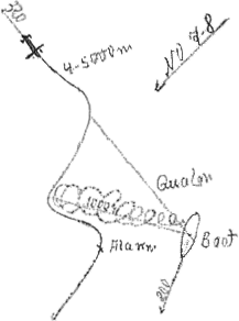 |
|
| |
|
|
| |
|
|
| |
|
At range = 400 meters the aircraft was on the correct course for the wind. At this moment I gave the order to crash dive. Before I got below I realized from an altitude of 150 meters [the aircraft turned sharply] over the right wing, lost altitude very quickly, the altitude of the aircraft when getting below was at most 20 meters. |
|
| |
|
I believe that the aircraft turned away due to the hits and did not complete its right turn before the wind (7-8), but impacted the water; there were no aircraft bombs. |
|
| |
|
09.20 |
|
Crash dive. |
|
| |
|
10.30 |
|
Surfaced. |
|
| |
|
12.00 |
KZ 4188 |
|
|
| |
|
|
Lat. - 34° 30'S |
|
|
| |
|
|
Long. - 27° 18'E |
Day's run: 182 nm Surfaced, 4 nm Submerged. |
|
| |
|
16.00 |
KZ 4452 |
|
|
| |
|
20.00 |
KZ 4488 |
|
|
| |
|
|
|
|
|
| |
|
|
|
|
|
| |
|
|
|
|
|
|
|
|
|
|
|
| |
- 44 - |
|
| |
|
|
|
|
|
| |
|
|
|
|
|
| |
|
|
|
|
|
| |
|
|
|
|
|
| |
|
13.05.43 |
Indian Ocean |
Course: 190°, turns for 8 knots. |
|
| |
|
00.00 |
KZ 4752 |
|
|
| |
|
|
NE 7, Sea 6, overcast, rain, Vis, medium |
|
|
| |
|
04.00 |
KZ 4782 |
|
|
| |
|
06.50 - 07.28 |
|
Exercise dive. |
|
| |
|
08.00 |
KZ 7125 |
|
|
| |
|
12.00 |
KZ 7181 |
|
|
| |
|
|
Lat. - 37° 22'S |
|
|
| |
|
|
Long. - 26° 50'E |
Day's run: 174.5 nm Surfaced, 1.5 nm Submerged. |
|
| |
|
16.00 |
KZ 7171 |
|
|
| |
|
20.00 |
KY 9394 |
|
|
| |
|
22.00 |
|
Outgoing Radio Message: 1834/13/2157/13/422. |
|
| |
|
|
|
4-7 May ordered traffic route nothing. Legs to KP 59 nothing. 8 May KP 9123 a destroyer and a corvette, crow's nests on both masts. Course 220°. 12 May KZ 4155 Handley Page. Shoot down very likely, after defense while crash diving just 20 meters altitude. Coastal traffic located at Cape St. Lucia. First 22 June supply square because there is still a possibility of lightening the boat. KY 95. |
|
| |
|
|
|
|
|
| |
|
14.05.43 |
Indian Ocean, south of the Agulhas Bank |
Course: 270°, turns for 8 knots. |
|
| |
|
00.00 |
KY 9384 |
|
|
| |
|
|
NW 4, Sea 4, overcast, rain, Vis. medium |
|
|
| |
|
04.00 |
KY 9374 |
|
|
| |
|
06.56 - 07.22 |
|
Exercise dive. |
|
| |
|
08.00 |
KY 9294 |
|
|
| |
|
12.00 |
KY 9284 |
|
|
| |
|
|
Lat. - 37° 11'S |
|
|
| |
|
|
Long. - 24° 40'E |
Day's run: 118 nm Surfaced, 2 nm Submerged. |
|
| |
|
16.00 |
KY 9277 |
|
|
| |
|
20.00 |
KY 9426 |
|
|
| |
|
|
|
|
|
| |
|
15.05.43 |
Indian Ocean, south of the Agulhas Bank |
Course: 250°, turns for 8 knots. |
|
| |
|
00.00 |
KY 9419 |
|
|
| |
|
|
SW 3, Sea 2, half overcast, Vis. good |
|
|
| |
|
04.00 |
KY 8665 |
|
|
| |
|
07.02 - 07.36 |
|
Exercise dive. |
|
| |
|
08.00 |
KY 8658 |
|
|
| |
|
12.00 |
GR 9999 |
|
|
| |
|
|
Lat. - 38° 01'S |
|
|
| |
|
|
Long. - 21° 58'E |
Day's run: 136.5 nm Surfaced, 2 nm Submerged. |
|
| |
|
|
|
|
|
| |
|
|
|
|
|
|
|
|
|
|
|
| |
- 45 - |
|
| |
|
|
|
|
|
| |
|
|
|
|
|
| |
|
|
|
|
|
| |
|
continued |
|
|
|
| |
|
15.05.43 |
South Atlantic, south of the Agulhas Bank |
|
|
| |
|
16.00 |
JJ 2122 |
|
|
| |
|
20.00 |
JJ 2115 |
|
|
| |
|
|
|
|
|
| |
|
16.05.43 |
South Atlantic, south of the Agulhas Bank |
Course: 250°, turns for 8 knots. |
|
| |
|
00.00 |
JJ 1361 |
|
|
| |
|
|
SW 2, high Swell, overcast, Vis. good |
|
|
| |
|
04.00 |
JJ 1354 |
|
|
| |
|
07.20 - 07.51 |
|
Exercise dive. |
|
| |
|
08.00 |
JJ 1347 |
|
|
| |
|
12.00 |
JJ 1465 |
|
|
| |
|
|
Lat. - 39° 26'S |
|
|
| |
|
|
Long. - 18° 20'E |
Day's run: 191 nm Surfaced, 1 nm Submerged. |
|
| |
|
16.00 |
JJ 1425 |
Course 330°, turns for 7 knots. |
|
| |
|
20.00 |
JJ 1415 |
|
|
| |
|
|
|
|
|
| |
|
17.05.43 |
South Atlantic southwest of Cape Town |
Course: 300°, turns for 7 knots. |
|
| |
|
00.00 |
GZ 3397 |
|
|
| |
|
|
SE 2, Sea 1, overcast, rain, Vis. medium |
|
|
| |
|
04.00 |
GZ 3381 |
|
|
| |
|
07.24 - 07.43 |
|
Exercise dive. |
|
| |
|
08.00 |
GZ 3344 |
|
|
| |
|
12.00 |
GZ 3256 |
|
|
| |
|
|
Lat. - 38° 33'S |
|
|
| |
|
|
Long. - 15° 39.7'E |
Day's run: 139.5 nm Surfaced, 1.5 nm Submerged. |
|
| |
|
16.00 |
GZ 3219 |
|
|
| |
|
|
[U-180 had 6 fresh water cooled Daimler Benz diesels in three pairs] |
Fresh coolant water loss has continually grown worse, the 3 engines had to be shut down temporarily. It turned out that No. 1 had seven No. 2 six, No. 3 five leaks in the cooling water jackets. Duration of repair (soldering) 2 1/2 days per engine. Since only one fresh water maker is operable - the other already failed on 23 March - as soon as there are leaks, it cannot meet the needs of the crew and the diesel so that the stocks must be drawn down. |
|
| |
|
|
|
|
|
| |
|
|
|
|
|
| |
|
|
|
|
|
| |
|
|
|
|
|
|
|
|
|
|
|
| |
- 46 - |
|
| |
|
|
|
|
|
| |
|
|
|
|
|
| |
|
|
|
|
|
| |
|
continued |
|
|
|
| |
|
17.05.43 |
South Atlantic southwest of Cape Town |
|
|
| |
|
|
Therefore fresh water may be a question of life for this type. Detecting and finding the leaks with the current design of the diesels is difficult and time-consuming, constructive change is required in such a way that it is immediately apparent which cylinder is leaking. |
|
| |
|
20.00 |
GZ 3132 |
|
|
| |
|
22.15 |
|
Outgoing Radio Message: 2135/17/468. |
|
| |
|
|
|
Brine pump one failed on 23 March, replacement requested from the supplier, because for three weeks many cylinder cooling jackets leak. To find and solder there is significant loss of fresh water, as a result at the moment two engines out of service. |
|
| |
|
|
|
- Musenberg - |
|
| |
|
|
|
|
|
| |
|
18.05.43 |
South Atlantic |
|
|
| |
|
00.00 |
GR 7985 |
|
|
| |
|
|
SE 3, Sea 1-2, half overcast, Vis. good |
Course: 300°, turns for 7 knots. |
|
| |
|
04.00 |
GR 7948 |
|
|
| |
|
07.22 - 07.44 |
|
Exercise dive. |
|
| |
|
08.00 |
GR 7861 |
|
|
| |
|
12.00 |
GR 7192 |
|
|
| |
|
|
Lat. - 36° 59.2'S |
|
|
| |
|
|
Long. - 12° 18.0'E |
Day's run: 182.5 nm Surfaced, 1.5 nm Submerged. |
|
| |
|
16.00 |
GR 7455 |
|
|
| |
|
20.00 |
GR 7417 |
|
|
| |
|
|
|
|
|
| |
|
19.05.43 |
South Atlantic |
|
|
| |
|
00.00 |
GQ 9623 |
Course: 300°, turns for 7 knots. |
|
| |
|
|
S 2, Sea 1, overcast, Vis. good |
|
|
| |
|
04.00 |
GQ 9376 |
|
|
| |
|
08.00 |
GQ 9266 |
|
|
| |
|
08.28 - 0828 |
|
Exercise dive. |
|
| |
|
12.00 |
GQ 9255 |
|
|
| |
|
|
Lat. - 31° 51.5'S |
|
|
| |
|
|
Long. - 09° 23'E |
Day's run: 156 nm Surfaced, 1 nm Submerged. |
|
| |
|
|
|
|
|
| |
|
|
|
|
|
|
|
|
|
|
|
| |
- 47 - |
|
| |
|
|
|
|
|
| |
|
|
|
|
|
| |
|
|
|
|
|
| |
|
continued |
|
|
|
| |
|
19.05.43 |
South Atlantic |
|
|
| |
|
16.00 |
GQ 9215 |
|
|
| |
|
20.00 |
GQ 6795 |
|
|
| |
|
|
|
|
|
| |
|
20.05.43 |
South Atlantic, west of Cape Town |
Course: 315°, turns for 7 knots. |
|
| |
|
00.00 |
GQ 6755 |
|
|
| |
|
|
SW 1, Sea 0, overcast, Vis. good |
|
|
| |
|
04.00 |
GQ 6715 |
|
|
| |
|
08.00 |
GQ 5695 |
|
|
| |
|
08.15 - 08.34 |
|
Exercise dive. |
|
| |
|
12.00 |
GQ 5659 |
|
|
| |
|
|
Lat. - 34° 06.4'S |
|
|
| |
|
|
Long. - 07° 17.8'E |
Day's run: 145.7 nm Surfaced, 1 nm Submerged. |
|
| |
|
16.00 |
GQ 5624 |
|
|
| |
|
20.00 |
GQ 5374 |
|
|
| |
|
|
|
|
|
| |
|
21.05.43 |
South Atlantic |
|
|
| |
|
00.00 |
GQ 5264 |
|
|
| |
|
|
N 3, Sea 2, few clouds, Vis. good |
|
|
| |
|
04.00 |
GQ 5225 |
|
|
| |
|
08.00 |
GQ 2878 |
|
|
| |
|
08.28 - 08.46 |
|
Exercise dive. |
|
| |
|
12.00 |
GQ 2777 |
|
|
| |
|
|
Lat. - 32° 19.4'S |
|
|
| |
|
|
Long. - 04° 59.9'E |
Day's run: 157 nm Surfaced, 1 nm Submerged. |
|
| |
|
16.00 |
GQ 2728 |
|
|
| |
|
20.00 |
GQ 2713 |
|
|
| |
|
|
|
|
|
| |
|
22.05.43 |
South Atlantic, west of Cape Town |
Course: 315°, turns for 7 knots. |
|
| |
|
00.00 |
GQ 1669 |
|
|
| |
|
|
SbyW 1-2, Sea 0-1, few clouds, Vis. good |
|
|
| |
|
04.00 |
GQ 1653 |
|
|
| |
|
08.00 |
GQ 1621 |
|
|
| |
|
08.37 - 09.10 |
|
Exercise dive. |
|
| |
|
|
|
|
|
| |
|
|
|
|
|
|
|
|
|
|
|
| |
- 48 - |
|
| |
|
|
|
|
|
| |
|
|
|
|
|
| |
|
|
|
|
|
| |
|
continued |
|
|
|
| |
|
22.05.43 |
South Atlantic, west of Cape Town |
|
|
| |
|
12.00 |
GQ 1268 |
|
|
| |
|
|
Lat. - 30° 32'S |
|
|
| |
|
|
Long. - 02° 49.9'E |
Day's run: 157.5 nm Surfaced, 1 nm Submerged. |
|
| |
|
16.00 |
GQ 1129 |
|
|
| |
|
20.00 |
GG 9787 |
|
|
| |
|
|
|
|
|
| |
|
23.05.43 |
|
Course: 315°, turns for 7 knots. |
|
| |
|
00.00 |
GG 8569 |
|
|
| |
|
|
SW 1, Sea 0, half overcast, Vis. good |
|
|
| |
|
04.00 |
GG 8529 |
|
|
| |
|
08.00 |
GG 8679 |
|
|
| |
|
08.54 - 09.20 |
|
Exercise dive. |
|
| |
|
12.00 |
GG 8565 |
|
|
| |
|
|
Lat. - 28° 40'S |
|
|
| |
|
|
Long. - 00° 38.4'E |
Day's run: 155.5 nm Surfaced, 1 nm Submerged. |
|
| |
|
16.00 |
GG 8528 |
|
|
| |
|
20.00 |
GG 8512 |
|
|
| |
|
|
|
|
|
| |
|
24.05.43 |
South Atlantic |
|
|
| |
|
00.00 |
GG 8192 |
|
|
| |
|
|
SbyE 4, Sea 3, overcast, Vis. good |
|
|
| |
|
04.00 |
GG 8152 |
|
|
| |
|
08.00 |
GG 8115 |
|
|
| |
|
08.30 - 09.00 |
|
Exercise dive. |
|
| |
|
12.00 |
GG 4994 |
|
|
| |
|
|
Lat. - 27° 08.5'S |
|
|
| |
|
|
Long. - 1° 15'E [typo W] |
Day's run: 135 nm Surfaced, 1.5 nm Submerged. |
|
| |
|
16.00 |
GG 4954 |
|
|
| |
|
20.00 |
GG 4917 |
|
|
| |
|
|
|
|
|
| |
|
25.05.43 |
South Atlantic |
|
|
| |
|
00.00 |
GG 4597 |
|
|
| |
|
|
SbyW 4, Sea 3-4, overcast, Vis. medium |
|
|
| |
|
04.00 |
GG 4557 |
|
|
| |
|
08.00 |
GG 4617 |
|
|
| |
|
|
|
|
|
| |
|
|
|
|
|
|
|
|
|
|
|
| |
- 49 - |
|
| |
|
|
|
|
|
| |
|
|
|
|
|
| |
|
|
|
|
|
| |
|
continued |
|
|
|
| |
|
25.05.43 |
South Atlantic |
|
|
| |
|
08.15 - 09.10 |
|
Exercise dive. |
|
| |
|
12.00 |
GG 4423 |
|
|
| |
|
|
Lat. - 25° 30.6'S |
|
|
| |
|
|
Long. - 3° 11.6'W |
Day's run: 145 nm Surfaced, 1 nm Submerged. |
|
| |
|
16.00 |
GG 4172 |
|
|
| |
|
20.00 |
GF 6362 |
|
|
| |
|
|
|
|
|
| |
|
26.05.43 |
South Atlantic |
Course: 315°, turns for 7 knots. |
|
| |
|
00.00 |
GF 6322 |
|
|
| |
|
|
SE 2, Sea 1-2, overcast, Vis. medium |
|
|
| |
|
04.00 |
GF 3972 |
|
|
| |
|
08.00 |
GF 3862 |
|
|
| |
|
08.56 - 09.18 |
|
Exercise dive. |
|
| |
|
12.00 |
GF 3812 |
|
|
| |
|
|
Lat. - 23° 32'S |
|
|
| |
|
|
Long. - 05° 19'W |
Day's run: 158 nm Surfaced, 1 nm Submerged. |
|
| |
|
16.00 |
GF 3498 |
|
|
| |
|
20.00 |
GF 3455 |
|
|
| |
|
|
|
|
|
| |
|
27.05.43 |
South Atlantic, south of St. Helena |
|
|
| |
|
00.00 |
GF 3415 |
|
|
| |
|
|
E 2, Sea 1, overcast, Vis. medium |
|
|
| |
|
04.00 |
GF 2395 |
|
|
| |
|
08.00 |
GF 2358 |
|
|
| |
|
09.02 - 09.51 |
|
Exercise dive. |
|
| |
|
12.00 |
GF 2239 |
|
|
| |
|
|
Lat. - 22° 05.5'S |
|
|
| |
|
|
Long. - 07° 18'W |
Day's run: 144.4 nm Surfaced, 2 nm Submerged. |
|
| |
|
16.00 |
FU 7897 |
|
|
| |
|
17.15 - 17.54 |
|
Crash dive for training for aircraft to depth A +20 meters. |
|
| |
|
20.00 |
FU 7857 |
|
|
| |
|
|
|
|
|
| |
|
|
|
|
|
|
|
|
|
|
|
| |
- 50 - |
|
| |
|
|
|
|
|
| |
|
|
|
|
|
| |
|
|
|
|
|
| |
|
|
|
|
|
| |
|
28.05.43 |
South Atlantic |
Course: 330°, turns for 7 knots. |
|
| |
|
00.00 |
FU 7815 |
|
|
| |
|
|
E 1, Sea 0, light overcast, Vis good |
|
|
| |
|
04.00 |
FU 7496 |
|
|
| |
|
08.00 |
FU 7461 |
|
|
| |
|
08.50 - 09.35 |
|
Exercise dive. |
|
| |
|
10.39 - 10.55 |
|
Crash dive for aircraft for training to depth A +20 meters. |
|
| |
|
12.00 |
FU 7413 |
|
|
| |
|
|
Lat. - 20° 09.5'S |
|
|
| |
|
|
Long. - 08° 50.5'W |
Day's run: 141.5 nm Surfaced, 4.5 nm Submerged. |
|
| |
|
16.00 |
FU 7147 |
|
|
| |
|
16.42 - 16.58 |
|
Crash dive for training for aircraft to depth A +20 meters. |
|
| |
|
17.08 - 17.20 |
|
" |
|
| |
|
20.00 |
FT 9338 |
|
|
| |
|
|
|
|
|
| |
|
29.05.43 |
South Atlantic |
Course: 300°, turns for 7 knots. |
|
| |
|
00.00 |
FT 6985 |
|
|
| |
|
|
E 2 Sea 1, light overcast, Vis. good |
|
|
| |
|
04.00 |
FT 6946 |
|
|
| |
|
08.00 |
FT 6911 |
|
|
| |
|
08.46 - 09.20 |
|
Exercise dive. |
|
| |
|
12.00 |
FT 6591 |
|
|
| |
|
|
Lat. - 18° 00.0'S |
|
|
| |
|
|
Long. - 10° 17.6'W |
Day's run: 152 nm Surfaced, 3 nm Submerged. |
|
| |
|
15.10 - 16.00 |
|
Crash dive for training for aircraft to depth A +20 meters 2 times. |
|
| |
|
16.00 |
FT 6557 |
|
|
| |
|
20.00 |
FT 6278 |
|
|
| |
|
|
|
|
|
| |
|
30.05.43 |
South Atlantic, west of St. Helena |
|
|
| |
|
00.00 |
FT 6166 |
|
|
| |
|
|
SE 3, Sea 2, overcast, Vis. medium |
|
|
| |
|
04.00 |
FT 6131 |
|
|
| |
|
|
|
|
|
| |
|
|
|
|
|
|
|
|
|
|
|
| |
- 51 - |
|
| |
|
|
|
|
|
| |
|
|
|
|
|
| |
|
|
|
|
|
| |
|
continued |
|
|
|
| |
|
30.05.43 |
South Atlantic |
|
|
| |
|
08.00 |
FT 3782 |
|
|
| |
|
08.23 - 08.50 |
|
Exercise dive. |
|
| |
|
12.00 |
FT 3741 |
|
|
| |
|
|
Lat. - 15° 56.2'S |
|
|
| |
|
|
Long. - 11° 44.0'W |
Day's run: 146 nm Surfaced, 4 nm Submerged. |
|
| |
|
16.00 |
FT 2698 |
|
|
| |
|
16.39 - 17.35 |
|
2 times crash dive for training for aircraft to depth A +20 meters. |
|
| |
|
20.00 |
FT 2659 |
|
|
| |
|
|
|
|
|
| |
|
31.05.43 |
South Atlantic |
Course: 330°, turns for 7 knots. |
|
| |
|
00.00 |
FT 2624 |
|
|
| |
|
|
SE 3, Sea 2, overcast, Vis. good |
|
|
| |
|
04.00 |
FT 2375 |
|
|
| |
|
08.00 |
FT 2263 |
|
|
| |
|
08.37 - 08.37 |
|
Exercise dive. |
|
| |
|
10.23 - 10.56 |
|
Crash dive for training to depth A +20 meters. |
|
| |
|
12.00 |
FT 2222 |
|
|
| |
|
|
Lat. - 13° 52.5'S |
|
|
| |
|
|
Long. - 13° 7.2'W |
Day's run: 144 nm Surfaced, 4 nm Submerged. |
|
| |
|
16.00 |
FM 8873 |
|
|
| |
|
20.00 |
FM 8817 |
|
|
| |
|
|
The crash dive exercises to depth A +20 meters have shown: the boat goes to the intended depth only with forward diving plane hard [down], aft diving plane to 20° [up]. At depth A +10 meters aft diving plane to neutral, then oscillate the boat at depth A +20. At any lower diving plane position, the boat oscillates too early (propeller wake and high stability) and then can no longer be caught bow down even with diving planes subsequently placed hard. In the process greatest bow down 23°, flood center after 10 seconds flood aft after 22-23 seconds, express at depth 30 meters; stern is then below depth A meters after 110 seconds and below the water surface after 50 seconds. At higher speeds must flood aft quicker to avoid too large a bow down angle. The above attempts were carried out at transit speed - turns for 7 knots. |
|
| |
|
|
|
|
|
| |
|
|
|
|
|
| |
|
|
|
|
|
| |
|
|
|
|
|
| |
|
|
|
|
|
|
|
|
|
|
|
| |
- 52 - |
|
| |
|
|
|
|
|
| |
|
|
|
|
|
| |
|
|
|
|
|
| |
|
continued |
|
|
|
| |
|
31.05.43 |
South Atlantic |
It is a fallacy to assume that the boat would be invisible to aircraft on leaving the surface because the white bubbles after expressing the negative buoyancy tanks is easy to see directly from the aircraft, these bubbles first appear [at the surface] after 120 seconds - when expressing at depth 30 meters expression is finished at depth A or A +10 meters - and precisely indicates the diving location again to the aircraft. Therefore it would be very desirable to avoid the air bubble when expressing by means of a corresponding technical modification (Japanese U-boats have just such equipment). |
|
| |
|
|
|
|
|
| |
|
01.06.43 |
South Atlantic, south of Ascension |
|
|
| |
|
00.00 |
FM 8498 |
Course: 330°, turns for 7 knots. |
|
| |
|
|
SE 3, overcast, Sea 3, Vis. medium |
|
|
| |
|
04.00 |
FM 8456 |
|
|
| |
|
08.00 |
FM 8424 |
At the level of Ascension already a boat was attacked by aircraft, air reconnaissance from Ascension must be expected, therefore from 08.00 hours MG and Fu.M.B. watch was set, turns for 9 knots. |
|
| |
|
08.31 - 09.21 |
|
Exercise dive. |
|
| |
|
11.52 |
FM 7393 |
Crash dive for aircraft, course 230°, bearing 320°T, 2-engined, very high. |
|
| |
|
12.00 |
FM 8174 |
|
|
| |
|
|
Lat. - 11° 47'S |
|
|
| |
|
|
Long. - 14° 29'W |
Day's run: 148 nm Surfaced, 1.4 nm Submerged. |
|
| |
|
13.30 |
|
Surfaced, course 310°, proceeding submerged had shown again that the boat takes on 3 tons of water, that means with the current filling of the aft trim tank is empty after 1 1/4 hours. At the moment there is no possibility to improve the trim, the 2 tons of gold on board is already forward. |
|
| |
|
|
|
|
| |
|
|
|
|
| |
|
|
|
|
| |
|
16.00 |
FM 7367 |
|
| |
|
|
|
|
|
| |
|
|
|
|
|
| |
|
|
|
|
|
| |
|
|
|
|
|
| |
|
|
|
|
|
| |
|
|
|
|
|
| |
|
|
|
|
|
|
|
|
|
|
|
| |
- 53 - |
|
| |
|
|
|
|
|
| |
|
|
|
|
|
| |
|
|
|
|
|
| |
|
continued |
|
|
|
| |
|
01.06.43 |
South Atlantic, south of Ascension |
|
|
| |
|
20.00 |
FM 7316 |
|
|
| |
|
|
|
|
|
| |
|
02.06.43 |
South Atlantic |
Course: 310°, turns for 9 knots. |
|
| |
|
|
FM 4899 |
|
|
| |
|
|
SE 4, Sea 3, overcast, rain, Vis. medium |
|
|
| |
|
04.00 |
FM 4855 |
|
|
| |
|
08.00 |
FM 4814 |
|
|
| |
|
08.30 - 09.14 |
|
Exercise dive. |
|
| |
|
12.00 |
FM 4489 |
|
|
| |
|
|
Lat. - 10° 09.9'S |
|
|
| |
|
|
Long. - 16° 37.0'W |
Day's run: 166 nm Surfaced, 8 nm Submerged. |
|
| |
|
16.00 |
FM 4473 |
|
|
| |
|
20.00 |
FL 6638 |
|
|
| |
|
|
|
|
|
| |
|
03.06.43 |
South Atlantic |
|
|
| |
|
00.00 |
FL 6387 |
|
|
| |
|
|
SE 3, Sea 3, few clouds, Vis. good |
|
|
| |
|
04.00 |
FL 6266 |
|
|
| |
|
08.00 |
FL 6225 |
|
|
| |
|
08.31 - 08.53 |
|
Exercise dive. |
|
| |
|
10.14 |
FL 6212 |
Crash dive for aircraft. Aircraft course 150°T, 260°R, very high. |
|
| |
|
10.59 |
|
Surfaced. |
|
| |
|
12.00 |
FL 3793 |
|
|
| |
|
|
Lat. - 8° 11.5'S |
|
|
| |
|
|
Long. - 19° 02'W |
Day's run: 182.5 nm Surfaced, 4 nm Submerged. |
|
| |
|
14.50 |
FL 3756 |
Crash dive for aircraft. Aircraft course 110°T, 245°R, 8000 meters, very high.2-engined. |
|
| |
|
15.46 |
|
Surfaced. |
|
| |
|
16.00 |
FL 3753 |
|
|
| |
|
17.07 |
FL 3754 |
Smoke cloud in sight, bearing 215°T. Single smokestack steamer comes in sight, shift shows enemy speed 9 knots, maneuvered ahead at 13 knots, higher speed impossible due to own smoke. Radio Message questioning attack permission because the boat is in an area where [I am] not free to attack. |
|
| |
|
20.00 |
FL 3734 |
|
|
| |
|
|
|
|
|
| |
|
|
|
|
|
|
|
|
|
|
|
| |
- 54 - |
|
| |
|
|
|
|
|
| |
|
|
|
|
|
| |
|
|
|
|
|
| |
|
continued |
|
|
|
| |
|
03.06.43 |
South Atlantic |
The message was sent again at 19.00 hours on Norddeich because at first we were not heard. Answered at 21.15 hours: Shoot if not a neutral. |
|
| |
|
|
|
Since it is daytime but too late for a twilight attack, attempted a night attack. The steamer was nearly lost in the twilight because he is positioned before a very unfavorable horizon and at the appropriate time made an evening zig zag of 50° to port. |
|
| |
|
23.40 |
FL 3816 |
3-fan sank steamer "BORIS" Greek from Santos to Freetown with wood, minerals, piece goods and cotton. Steamer course 90°, evening zigzag to 40°. 2 coup de grâce because the steamer did not sink, floated on its wood cargo. |
|
| |
|
|
|
|
|
| |
|
04.06.43 |
South Atlantic |
|
|
| |
|
00.00 |
FL 3812 |
Course: 330°, turns for 14 knots to move off. |
|
| |
|
|
SE 2, Sea 1, few clouds, Vis. good |
|
|
| |
|
04.00 |
FL 3437 |
|
|
| |
|
08.00 |
FL 3142 |
Turns for 9 knots. |
|
| |
|
08.30 - 08.51 |
|
Exercise dive. |
|
| |
|
12.00 |
FD 9998 |
|
|
| |
|
|
Lat. - 5° 37.8'S |
|
|
| |
|
|
Long. - 20° 05.7'W |
Day's run: 218 nm Surfaced, 4.5 nm Submerged. |
|
| |
|
16.00 |
FD 9952 |
|
|
| |
|
20.00 |
FD 9675 |
|
|
| |
|
21.03 |
|
Outgoing Radio Message: 2025/4/464. |
|
| |
|
|
|
Crash dive for aircraft: 1 June FM 73, course 230°, 11.50 hours, 3 June FL 62 course 150°, 1015 hours and FL 37 course 110°, 14.50 hours, apparently regular reconnaissance from Ascension for east-west traffic, no detections, aircraft very high. 3 June FL 3816 23.40 hours sank "BORIS" from Santos to Freetown with wood, minerals and piece goods course 90°, evening zigzag to 40°. |
|
| |
|
|
|
|
|
| |
|
05.06.43 |
South Atlantic |
|
|
| |
|
00.00 |
FD 9566 |
|
|
| |
|
|
SE 2, Sea 1, few clouds, Vis. good |
|
|
| |
|
04.00 |
FD 9531 |
|
|
| |
|
08.00 |
FD 9258 |
|
|
| |
|
12.00 |
FD 9139 |
|
|
| |
|
|
Lat. - 3° 13.6'S |
|
|
| |
|
|
Long. - 21° 42.7'W |
Day's run: 175 nm Surfaced |
|
| |
|
|
|
|
|
|
|
|
|
|
|
| |
- 55 - |
|
| |
|
|
|
|
|
| |
|
|
|
|
|
| |
|
|
|
|
|
| |
|
continued |
|
|
|
| |
|
05.06.43 |
South Atlantic |
|
|
| |
|
16.00 |
FD 6794 |
|
|
| |
|
20.00 |
FD 6755 |
|
|
| |
|
|
|
|
|
| |
|
06.06.43 |
South Atlantic, Equator |
|
|
| |
|
00.00 |
FD 6713 |
|
|
| |
|
|
SE 2, Sea 1, lightly cloudy, Vis. good |
|
|
| |
|
04.00 |
FD 6471 |
|
|
| |
|
08.00 |
FD 5638 |
|
|
| |
|
12.00 |
FD 5378 |
|
|
| |
|
|
Lat. - 1° 11.8'S |
|
|
| |
|
|
Long. - 23° 20.9'W |
Day's run: 158 nm Surfaced |
|
| |
|
16.00 |
FD 5269 |
|
|
| |
|
20.00 |
FD 5234 |
|
|
| |
|
|
|
|
|
| |
|
07.06.43 |
South Atlantic, Equator |
Course: 330°, turns for 7 knots. |
|
| |
|
00.00 |
FD 2885 |
|
|
| |
|
|
SE 2, Sea 1, clear sky, Vis. good |
|
|
| |
|
01.25 |
|
Passed the Equator in a northerly direction at longitude 24° 01.5'W. |
|
| |
|
04.00 |
FD 2843 |
|
|
| |
|
08.00 |
FD 2811 |
|
|
| |
|
08.24 - 08.55 |
|
Exercise dive. |
|
| |
|
12.00 |
FD 2455 |
|
|
| |
|
|
Lat. - 1° 00.8'N |
|
|
| |
|
|
Long. - 24° 49.5'W |
Day's run: 158 nm Surfaced, 2 nm Submerged. |
|
| |
|
16.00 |
FD 2916 |
The sinking of "BORIS" makes down loading torpedoes necessary, in fact 2 stern torpedoes to the bow room, 2 torpedoes from the forward upper deck canisters into the bow room. The boat finally gets sufficient fillings for the trim tanks, while the down loaded weight has practically no effect. The down loading takes 12 hours as a result of the loaded condition of the boat in the rooms. |
|
| |
|
20.00 |
FD 2177 |
|
|
| |
|
|
|
|
|
| |
|
08.06.43 |
Central Atlantic |
|
|
| |
|
00.00 |
FD 1368 |
|
|
| |
|
|
SE 1, Sea 0-1, lightly cloudy, Vis. good |
|
|
| |
|
|
|
|
|
| |
|
|
|
|
|
|
|
|
|
|
|
| |
- 57 - |
|
| |
|
|
|
|
|
| |
|
|
|
|
|
| |
|
|
|
|
|
| |
|
|
|
|
|
| |
|
continued |
|
|
|
| |
|
09.06.43 |
Central Atlantic |
Course: 300°, turns for 7 knots. |
|
| |
|
|
|
The course is continued farther than intended, but it is impossible for this boat to steer a course where smoke rises from the aft over the bridge. |
|
| |
|
00.00 |
ES 7426 |
|
|
| |
|
|
SSE 2, Sea 1, few clouds, Vis. good |
|
|
| |
|
08.00 |
ER 9392 |
|
|
| |
|
08.29 - 08.58 |
|
Exercise dive. |
|
| |
|
12.00 |
ER 9328 |
|
|
| |
|
|
Lat. - 04° 48.5'N |
|
|
| |
|
|
Long. - 28° 27.3'W |
Day's run: 140 nm Surfaced, 8.5 nm Submerged. |
|
| |
|
13.55 |
|
Incoming Radio Message: 1255/9/302. concerning orders to head for naval square DG 74. (for supply) |
|
| |
|
16.00 |
ER 6979 |
|
|
| |
|
20.00 |
ER 6866 |
|
|
| |
|
22.20 - 01.57 |
|
Stopped to repack the stern tubes. |
|
| |
|
|
|
|
|
| |
|
10.06.43 |
Central Atlantic |
|
|
| |
|
00.00 |
ER 6838 |
Course: 325°, turns for 7 knots. |
|
| |
|
|
SSE 1, Sea 0-1, half overcast, Vis. good |
|
|
| |
|
04.00 |
ER 6825 |
|
|
| |
|
08.00 |
ER 6582 |
|
|
| |
|
08.55 - 09.14 |
|
Exercise dive. |
|
| |
|
12.00 |
ER 6521 |
|
|
| |
|
|
Lat. - 06° 48'N |
|
|
| |
|
|
Long. - 29° 26'W |
Day's run: 133.8 nm Surfaced, 1 nm Submerged. |
|
| |
|
16.00 |
ER 6249 |
|
|
| |
|
20.00 |
ER 6216 |
|
|
| |
|
|
|
|
|
| |
|
11.06.43 |
Central Atlantic |
|
|
| |
|
00.00 |
ER 3872 |
Course: 350°, turns for 7 knots. |
|
| |
|
|
|
|
|
| |
|
|
|
|
|
| |
|
|
|
|
|
| |
|
|
|
|
|
|
|
|
|
|
|
| |
- 58 - |
|
| |
|
|
|
|
|
| |
|
|
|
|
|
| |
|
|
|
|
|
| |
|
continued |
|
|
|
| |
|
11.06.43 |
Central Atlantic |
Course: 350°, turns for 7 knots. |
|
| |
|
00.00 |
ER 3872 |
|
|
| |
|
|
NE 1, Sea 0m lightly overcast, Vis. good |
|
|
| |
|
04.00 |
ER 3814 |
|
|
| |
|
08.00 |
ER 3493 |
|
|
| |
|
|
Rain |
|
|
| |
|
09.05 - 09.25 |
|
Exercise dive. |
|
| |
|
12.00 |
ER 3439 |
|
|
| |
|
|
Lat. - 09° 18.7'N |
|
|
| |
|
|
Long. - 29° 51.5'W |
Day's run: 151.8 nm Surfaced, 1 nm Submerged. |
|
| |
|
|
Overcast, rain |
|
|
| |
|
16.00 |
ER 3195 |
|
|
| |
|
20.00 |
ER 3164 |
|
|
| |
|
|
|
|
|
| |
|
12.06.43 |
Central Atlantic, southwest of Cape Verde |
|
|
| |
|
00.00 |
ER 3123 |
|
|
| |
|
|
NE 4, Sea 3-4, overcast, rain, Vis. medium |
|
|
| |
|
04.00 |
EH 9783 |
|
|
| |
|
08.00 |
EH 9728 |
|
|
| |
|
08.45 - 09.05 |
|
Exercise dive. |
|
| |
|
12.00 |
EH 9724 |
|
|
| |
|
|
Lat. - 11° 14.2'N |
|
|
| |
|
|
Long. - 30° 22.1'W |
Day's run: 122 nm Surfaced, 1 nm Submerged. |
|
| |
|
16.00 |
EH 9476 |
|
|
| |
|
20.00 |
EH 9445 |
|
|
| |
|
|
|
|
|
| |
|
13.06.43 |
Central Atlantic |
|
|
| |
|
|
|
|
|
| |
|
|
|
|
|
| |
|
|
|
|
|
| |
|
|
|
|
|
| |
|
|
|
|
|
| |
|
|
|
|
|
| |
|
|
|
|
|
|
|
|
|
|
|
| |
- 59 - |
|
| |
|
|
|
|
|
| |
|
|
|
|
|
| |
|
|
|
|
|
| |
|
continued |
|
|
|
| |
|
13.06.43 |
Central Atlantic |
|
|
| |
|
00.00 |
ER 9178 |
|
|
| |
|
|
NE 3, Sea 2, overcast, Vis. medium |
|
|
| |
|
04.00 |
EH 9144 |
|
|
| |
|
08.00 |
EH 8333 |
|
|
| |
|
08.48 - 09.14 |
|
Exercise dive. |
|
| |
|
12.00 |
EH 5991 |
|
|
| |
|
|
Lat. - 13° 24.1'N |
|
|
| |
|
|
Long. - 30° 54.2'W |
Day's run: 133 nm Surfaced, 1 nm Submerged. |
|
| |
|
16.00 |
EH 5961 |
|
|
| |
|
20.00 |
EH 5689 |
|
|
| |
|
|
|
|
|
| |
|
14.06.43 |
Central Atlantic |
|
|
| |
|
00.00 |
EH 5663 |
|
|
| |
|
|
NE 3, Sea 2, overcast, Vis. good |
|
|
| |
|
04.00 |
EH 5622 |
|
|
| |
|
08.00 |
EH 5357 |
|
|
| |
|
09.08 - 09.30 |
|
Exercise dive. |
|
| |
|
12.00 |
EH 5352 |
|
|
| |
|
|
Lat. - 15° 36'N |
|
|
| |
|
|
Long. - 31° 10'W |
Day's run: 134 nm Surfaced, 1 nm Submerged. |
|
| |
|
16.00 |
EH 2978 |
|
|
| |
|
20.00 |
EH 2946 |
|
|
| |
|
|
|
|
|
| |
|
15.06.43 |
Central Atlantic, west of Cape Verde |
Course: 350°, turns for 7 knots. |
|
| |
|
|
NE 4, Sea 3, half overcast, Vis. good |
|
|
| |
|
|
|
|
|
| |
|
|
|
|
|
| |
|
|
|
|
|
| |
|
|
|
|
|
| |
|
|
|
|
|
| |
|
|
|
|
|
| |
|
|
|
|
|
| |
|
|
|
|
|
|
|
|
|
|
|
| |
- 61 - |
|
| |
|
|
|
|
|
| |
|
|
|
|
|
| |
|
|
|
|
|
| |
|
continued |
|
|
|
| |
|
17.06.43 |
Central Atlantic |
|
|
| |
|
08.00 |
DS 5755 |
|
|
| |
|
10.12 - 10.44 |
|
Crash dive for training. |
|
| |
|
11.16 - 11.38 |
|
Crash dive for training to depth A +20 meters. |
|
| |
|
12.00 |
DS 5719 |
|
|
| |
|
|
Lat. - 21° 56.9'N |
|
|
| |
|
|
Long. - 35° 10.0'W |
Day's run: 139 nm Surfaced, 3 nm Submerged. |
|
| |
|
16.00 |
DS 5472 |
|
|
| |
|
20.00 |
DS 5417 |
|
|
| |
|
|
|
|
|
| |
|
18.06.43 |
Central Atlantic |
|
|
| |
|
00.00 |
DS 4396 |
|
|
| |
|
|
NE 3, Sea 2, overcast, Vis. good |
|
|
| |
|
04.00 |
DS 4338 |
|
|
| |
|
08.00 |
DS 1993 |
|
|
| |
|
10.50 - 11.31 |
|
2 times crash dive for training at higher speed. |
|
| |
|
12.00 |
DS 1928 |
|
|
| |
|
|
Lat. - 24° 38.3'N |
|
|
| |
|
|
Long. - 33° 48.0'W |
Day's run: 158 nm Surfaced, 1.5 nm Submerged. |
|
| |
|
16.00 |
DS 1685 |
|
|
| |
|
20.00 |
DS 1651 |
|
|
| |
|
|
|
|
|
| |
|
19.06.43 |
Central Atlantic |
Course: 354°, turns for 7 knots. |
|
| |
|
00.00 |
DS 1379 |
|
|
| |
|
|
NE 3, Sea 2, overcast, Vis. good |
|
|
| |
|
04.00 |
DS 1345 |
|
|
| |
|
08.00 |
DS 1312 |
|
|
| |
|
09.00 |
DG 7776 |
U-530 in sight bearing 320°T, 6 nm away. |
|
| |
|
10.15 |
|
Began fuel oil transfer. Course 270°. |
|
| |
|
12.00 |
DF 9996 |
|
|
| |
|
|
Lat. - 26° 49.9'N |
|
|
| |
|
|
Long. - 34° 25.8'W |
Day's run: 134 nm Surfaced. |
|
| |
|
|
|
|
|
| |
|
|
|
|
|
| |
|
|
|
|
|
|
|
|
|
|
|
| |
- 62 - |
|
| |
|
|
|
|
|
| |
|
|
|
|
|
| |
|
|
|
|
|
| |
|
continued |
|
|
|
| |
|
19.06.43 |
Central Atlantic |
|
|
| |
|
16.00 |
DF 9995 |
|
|
| |
|
19.00 |
|
Fuel oil transfer ended, return transit via DG 7777 for U-530 to give a Metox to U-572. |
|
| |
|
20.00 |
DF 9995 |
|
|
| |
|
23.00 |
DG 7777 |
Met U-572, U-530 gave a Metox to the boat. |
|
| |
|
23.15 |
|
Together return transit with U-530. |
|
| |
|
|
|
Course 50°, turns for 9 knots. |
|
| |
|
|
|
|
|
| |
|
20.06.43 |
Central Atlantic, 900 nm west abeam the Canary Islands |
|
|
| |
|
00.00 |
DG 7775 |
|
|
| |
|
|
NE 2, Sea 0-1, light overcast, Vis. good |
|
|
| |
|
04.00 |
DG 7755 |
|
|
| |
|
08.00 |
DG 7735 |
|
|
| |
|
08.48 - 09.14 |
|
Exercise dive. |
|
| |
|
12.00 |
DG 7572 |
|
|
| |
|
|
Lat. - 27° 49.3'N |
|
|
| |
|
|
Long. - 32° 54.8'W |
Day's run: 134.5 nm Surfaced, 1 nm Submerged. |
|
| |
|
16.00 |
DG 7552 |
|
|
| |
|
20.00 |
DG 7299 |
|
|
| |
|
|
|
|
|
| |
|
21.06.43 |
North Atlantic |
Course: 50°, turns for 9 knots. |
|
| |
|
00.00 |
DG 7349 |
|
|
| |
|
|
E 2, Sea 1, light overcast, Vis. good |
|
|
| |
|
04.00 |
DG 7334 |
|
|
| |
|
08.00 |
DG 5775 |
|
|
| |
|
08.40 - 09.09 |
|
Exercise dive. |
|
| |
|
12.00 |
DG 5751 |
|
|
| |
|
|
Lat. - 29° 56.8'N |
|
|
| |
|
|
Long. - 30° 14.0'W |
Day's run: 186 nm Surfaced, 1 nm Submerged. |
|
| |
|
16.00 |
DG 5731 |
|
|
| |
|
20.00 |
DG 5548 |
|
|
| |
|
|
|
|
|
| |
|
|
|
|
|
|
|
|
|
|
|
| |
- 63 - |
|
| |
|
|
|
|
|
| |
|
|
|
|
|
| |
|
|
|
|
|
| |
|
|
|
|
|
| |
|
22.06.43 |
North Atlantic |
Course: 50°. turns for 9 knots. |
|
| |
|
00.00 |
DG 5529 |
|
|
| |
|
|
NNE 1, Sea 0, few clouds, Vis. good |
|
|
| |
|
04.00 |
DG 5296 |
|
|
| |
|
08.00 |
DG 5554 |
Course 36°. |
|
| |
|
08.24 - 08.45 |
|
Exercise dive. |
|
| |
|
12.00 |
DG 2986 |
|
|
| |
|
|
Lat. - 32° 13'N |
|
|
| |
|
|
Long. - 27° 36'W |
Day's run: 192.5 nm Surfaced, 1 nm Submerged. |
|
| |
|
16.00 |
DG 2963 |
|
|
| |
|
20.00 |
DG 3478 |
|
|
| |
|
|
|
|
|
| |
|
23.06.43 |
North Atlantic |
Course: 36°, turns for 9 knots. |
|
| |
|
00.00 |
DG 3452 |
|
|
| |
|
|
NE 2-3, Sea 2, lightly cloudy, Vis. good |
|
|
| |
|
04.00 |
DG 3198 |
|
|
| |
|
08.00 |
DG 3245 |
|
|
| |
|
08.04 - 08.36 |
|
Dived for training. |
|
| |
|
12.00 |
DG 3213 |
|
|
| |
|
|
Lat. - 34° 45.7'N |
|
|
| |
|
|
Long. - 25° 32.1'W |
Day's run: 183.5 nm Surfaced, 1.5 nm Submerged. |
|
| |
|
16.00 |
CE 9959 |
|
|
| |
|
20.00 |
CE 9935 |
|
|
| |
|
|
|
|
|
| |
|
24.06.43 |
North Atlantic |
|
|
| |
|
00.00 |
CF 7549 |
|
|
| |
|
|
NE 1, Sea 0, few clouds, Vis. good |
|
|
| |
|
04.00 |
CF 7526 |
|
|
| |
|
08.00 |
CF 7293 |
|
|
| |
|
|
|
|
|
| |
|
|
|
|
|
| |
|
|
|
|
|
| |
|
|
|
|
|
| |
|
|
|
|
|
|
|
|
|
|
|
| |
- 64 - |
|
| |
|
|
|
|
|
| |
|
|
|
|
|
| |
|
|
|
|
|
| |
|
continued |
|
|
|
| |
|
24.06.43 |
North Atlantic |
|
|
| |
|
08.04 - 08.35 |
|
Exercise dive. |
|
| |
|
12.00 |
CF 7312 |
|
|
| |
|
|
Lat. - 37° 24'N |
|
|
| |
|
|
Long. - 23° 16.5'W |
Day's run: 192.5 nm Surfaced, 1.5 nm Submerged. |
|
| |
|
16.00 |
CF 4938 |
|
|
| |
|
20.00 |
CF 4933 |
|
|
| |
|
|
|
|
|
| |
|
25.06.43 |
North Atlantic |
Course 42°, turns for 9 knots. |
|
| |
|
00.00 |
CF 5473 |
|
|
| |
|
|
NE 3, Sea 1-2, overcast, Vis. medium |
|
|
| |
|
04.00 |
CF 5429 |
|
|
| |
|
07.43 - 08.14 |
|
Exercise dive. |
|
| |
|
08.00 |
CF 5196 |
|
|
| |
|
12.00 |
CF 5241 |
|
|
| |
|
|
Lat. - 39° 48'N |
|
|
| |
|
|
Long. - 20° 59'W |
Day's run: 180 nm Surfaced, 1 nm Submerged. |
|
| |
|
16.00 |
CF 5222 |
|
|
| |
|
20.00 |
CF 2865 |
|
|
| |
|
|
|
|
|
| |
|
26.06.43 |
North Atlantic |
Course: 50°, turns for 9 knots. |
|
| |
|
00.00 |
CF 2927 |
|
|
| |
|
|
NE 2, Sea 0-1, overcast, Vis. medium |
|
|
| |
|
04.00 |
CF 2697 |
|
|
| |
|
|
NE 4, high Swell |
|
|
| |
|
07.38 |
|
Dived to proceed submerged. |
|
| |
|
08.00 |
CF 3448 |
|
|
| |
|
12.00 |
CF 3446 |
|
|
| |
|
|
|
|
|
| |
|
|
|
|
|
| |
|
|
|
|
|
| |
|
|
|
|
|
| |
|
|
|
|
|
| |
|
|
|
|
|
| |
|
|
|
|
|
|
|
|
|
|
|
| |
- 66 - |
|
| |
|
|
|
|
|
| |
|
|
|
|
|
| |
|
|
|
|
|
| |
|
continued |
|
|
|
| |
|
28.06.43 |
|
|
|
| |
|
12.00 |
CH 1133 |
|
|
| |
|
|
Lat. - 42° 50'N |
|
|
| |
|
|
Long. - 13° 58'W |
Day's run: 81.8 nm Surfaced, 30.7 nm Submerged. |
|
| |
|
16.00 |
BE 9887 |
|
|
| |
|
19.00 |
|
Surfaced. |
|
| |
|
20.00 |
BE 9886 |
|
|
| |
|
23.27 |
EbyN 3, overcast, misty |
Dived to proceed submerged. |
|
| |
|
|
|
|
|
| |
|
29.06.43 |
North Atlantic |
|
|
| |
|
00.00 |
BE 9893 |
Course 74°. |
|
| |
|
04.00 |
BE 9971 |
|
|
| |
|
06.31 |
|
Surfaced. |
|
| |
|
08.00 |
BE 9957 |
|
|
| |
|
11.07 |
EbyN 5, Sea 4, misty, low Stratus |
Dived to proceed submerged. |
|
| |
|
12.00 |
BE 9964 |
|
|
| |
|
|
Lat. - 43° 20'N |
|
|
| |
|
|
Long. - 12° 00'W |
Day's run: 64.9 nm Surfaced, 25.5 nm Submerged. |
|
| |
|
16.00 |
BE 9965 |
|
|
| |
|
19.00 |
|
Surfaced. |
|
| |
|
20.00 |
BF 7741 |
|
|
| |
|
23.46 |
EbyN 5, Sea 3-4, misty, low Stratus |
Dived to proceed submerged. |
|
| |
|
|
|
|
|
| |
|
30.06.43 |
Bay of Biscay |
Course 61°. |
|
| |
|
00.00 |
BF 7734 |
|
|
| |
|
04.00 |
BF 7732 |
|
|
| |
|
06.00 |
|
Surfaced. |
|
| |
|
07.30 |
|
Aircraft ahead to port. Aircraft came out of the clouds, so that it was too late to crash dive. I attempted to keep the aircraft always astern and in so doing ran in two full circles. The aircraft circles at a distance of |
|
| |
|
|
|
|
|
| |
|
|
|
|
|
| |
|
|
|
|
|
| |
|
|
|
|
|
| |
|
|
|
|
|
|
|
|
|
|
|
| |
|
|
| |
|
|
| |
Comments of the Befehlshabers der Unterseeboote |
|
| |
on the K.T.B. of "U-180" (Musenberg) from 9.2. - 3.7.43. |
|
| |
|
|
| |
First patrol of the Kommandant with a new boat. |
|
| |
The special task was carried out as planned and was well considered. The boat coped well with the difficulties of first testing a completely new engine layout and gained valuable experience. The combat task had to step into the background because of the special circumstances of the patrol. Therefore the sinking of two steamers is especially pleasing. The behavior during the aircraft attacks was good, a shoot down can be accepted as likely. The special technical experience of the boat will be evaluated and considered separately. The boat will no longer be used as a combat boat. |
|
| |
Accredited successes: |
|
| |
1 steamer 8132 GRT sunk |
|
| |
1 steamer 5166 " " |
|
| |
1 aircraft shoot down likely |
|
| |
|
|
| |
|
For the Befehlshabers der Unterseeboote |
|
| |
|
The Chief of the Operations Department. |
|
| |
|
 |
|
| |
|
|
| |
|
|
| |
 |
|
| |
|
|
|
|
|